February 2026
54°57'12.56"N 4°25'9.74"W
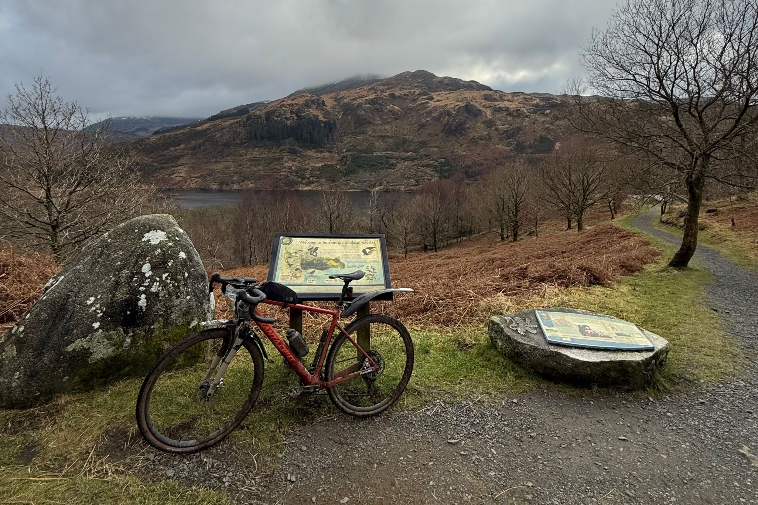
We’re heading north of the border this month for a truly spectacular wilderness ride around the forests and mountain lochs of Galloway. Stick to forest tracks and quiet back roads for a totally drop bar friendly 70km loop. Or add on extra natural and man made singletrack sections at the MTB centres of Kirroughtree and Glentrool if you want something more XC MTB. There’s also an off road shortcut that dodges a section of (very quiet) main road to create a 63km option.
Whichever you choose expect stunning scenery, silent solitude and a true taste of ‘out there’ in the shadow of southern Scotland’s highest mountain as well as views south to the sea of the Solway Firth. Keep your eyes peeled for the eagles, ospreys, peregrines, red squirrels, red deer and even wild goats who are lucky enough to call this area home.
While the riding itself is relatively simple, you will be a long way from civilisation for a lot of the route so it’s not one for the nervous or novices. High levels of weather exposure over Glenhead means you need to keep a close eye on the forecast and prepare accordingly too. The sense of achievement you’ll get as you roll back into Kirroughtree will definitely make the effort worthwhile though. Especially if the excellent cafe is still open.
POLARIS Glentrool Gravel
70.2KM, 1,063M VERTICAL
Start and finish point - As well as an excellent cafe and a range of MTB trails from green to black grade, Kirroughtree visitor centre is also home to the excellent Brake Pad bike shop for spares, repairs and bike hire.
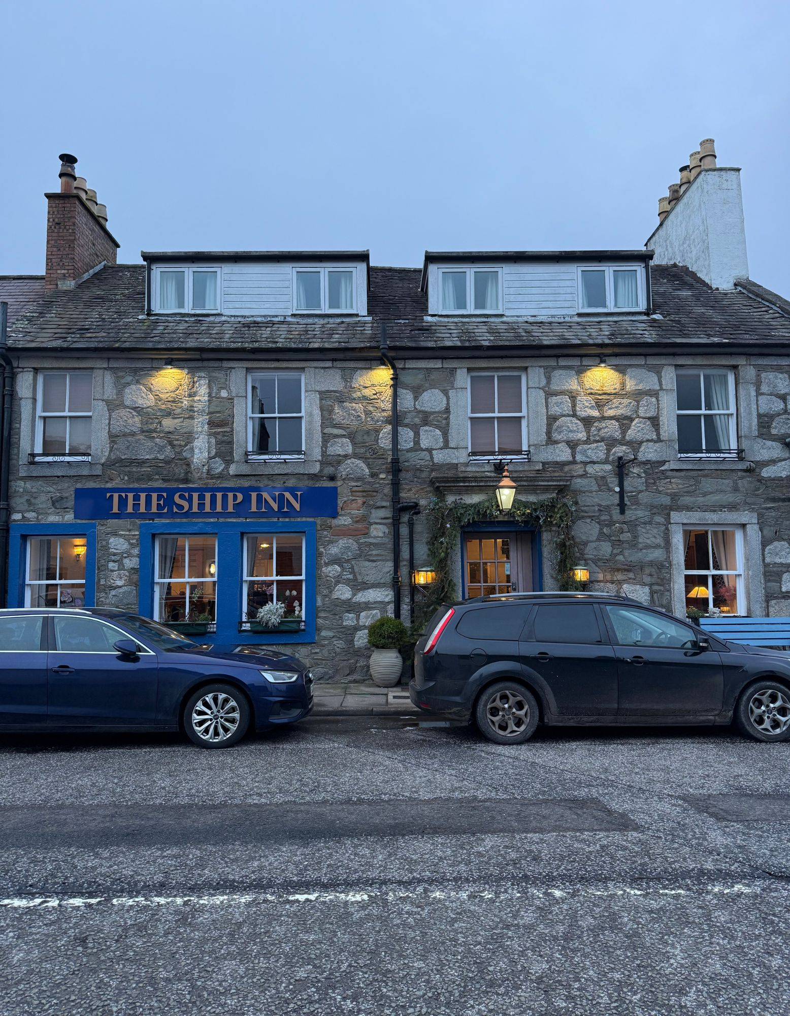
Alternatively, you can start and finish in Newton Stewart which you pass through at 10km otherwise. Gatehouse of Fleet just down the road is becoming a global renowned gravel hub too and we stayed at the excellent, bike friendly Ship Inn to scope this route out.
what3words ///reshaping.brand.texted
This what3words address refers to a 3 metre square location. Tap the link or enter the 3 words into the free what3words app to find it.
For full navigation data download the GPX file and watch the Strava fly through. Then watch our ride video for a highlights preview of the route.
Stops & shops
Once you’ve left Kirroughtree the next opportunity to refuel is Newton Stewart at 10km. There is a visitor centre at Glentrool (27km) but opening times are seasonal so double check before you rely on it. The same applies to the new ‘Wriggly Tin’ Cafe and Honesty Hut at Glenhead (34km).
Unfortunately the visitor centre at Clatteringshaws is currently closed as well but will reopen this year as the Scottish Dark Skies Observatory, complete with stargazing telescopes and a cafe. When it’s open you’ll find this a km north up the main road from the T junction at 52km.
From here on though, unless the wild goats decide to go into catering, there’s no food or drink stops for the rest of the route.
In other words, in winter you should plan to do the full route with the food and drink you carry and still expect big unsupported stretches in summer.
Route information
Kirroughtree - Minnigaff 0 - 10km
If the forestry work that was ongoing when we visited is finished, take the Blue grade MTB route from the visitor centre car park and follow it as it winds up Daltamie Hill. If they’re still logging, drop down to the entrance to the visitor centre and then turn right up the narrow back road of National Cycle Route 7. After 2km you should be able to divert back into the forest at the top of the climb to rejoin the Blue route.
From here follow the mix of short man-made singletrack and fire road sections of the signposted Blue to 4km where it curves back south east into the forest. At this point we curve back around in the opposite direction on the fire road, where hopefully they’ve cleared the fallen trees I had to fight through. Now follow the fire road as it swoops down to a switchback and then a small car park at 5km.
Turn right onto the least ‘main’ main road you’ll ever experience before peeling off after a km onto a rough back road. This gradually curves west and then south west with fantastic views of the hills and forests of the ride to come across Glenhoise Deer Park. Watch out on the narrow descent through the wood though as minimal traffic means it can be green and slippery when wet. Follow the road into the appropriately tiny village of Minnigaff on the north edge of Newton Stewart. Turn sharp left to reveal a lovely view down the River Cree into town, complete with a lovely historic ‘suspension’ footbridge and remains of the medieval castle mound on the far bank.
Minnigaff - Glentrool visitor centre 10 - 27km
Climbing north again you’re rewinding further back into prehistory with several cairns and old settlement enclosures hidden in the moors and forests overlooking you from the rising hills to your right. As you drop down to the River Cree it’s back to more modern landscape stories with the remains of an old lead mine and smithy hidden in the woods to the right, and the fancy wedding and events hotel of Penninghame Estate on the far bank.
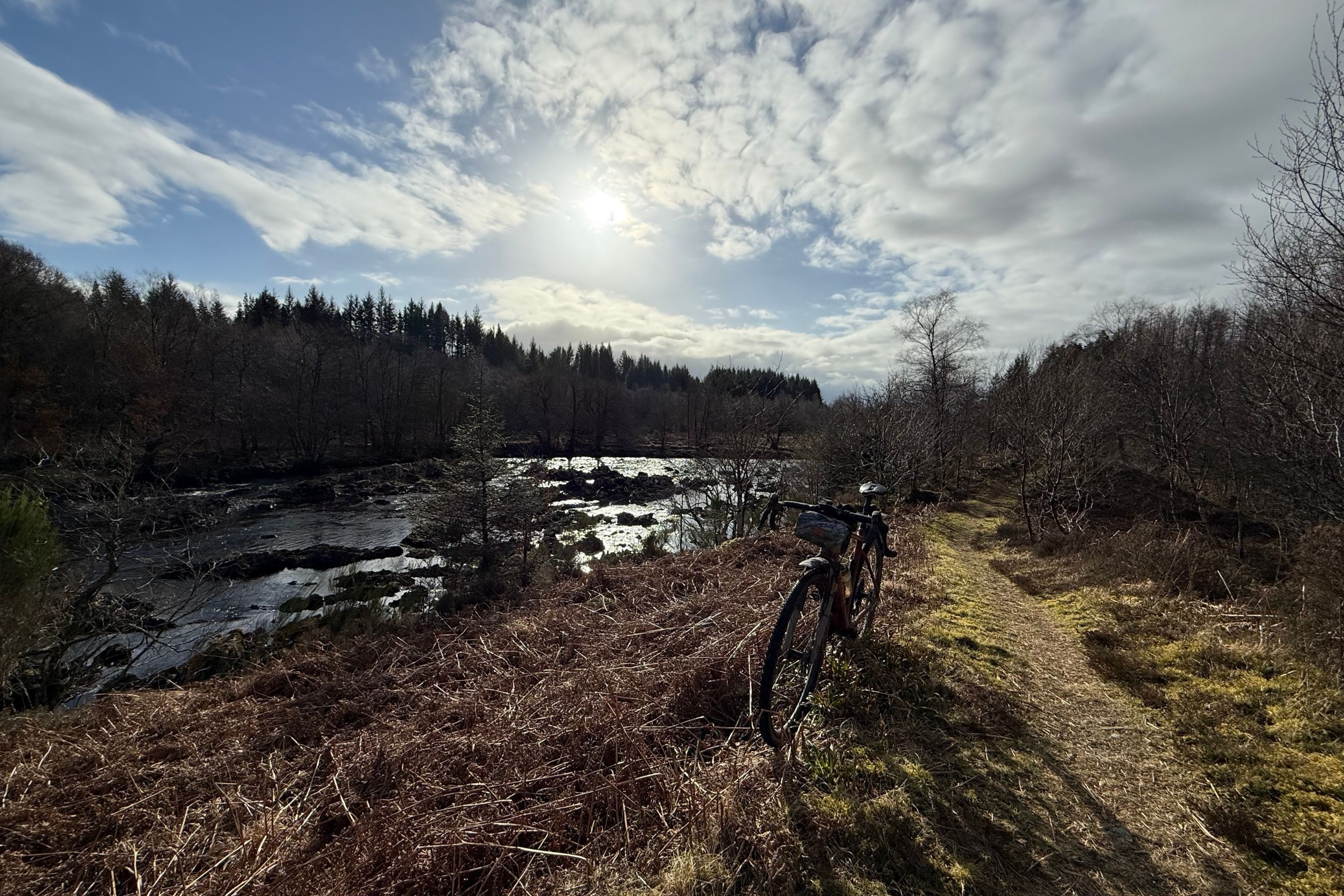
Whatever festivities might happen there though, the overwhelming sense here is timeless serenity as you roll north with the nature reserve of Cree Wood on your right, and the broadening Cree river actually being designated a Loch at this point. Don’t miss the picture pretty waterfalls at Cordorcan Bridge either, but do be careful to miss the actual bridge as its narrow stone walls are quite a pinch point.
As the road roughens up and becomes more gravelly at the 20km mark it’s time to make a terrain decision.
1: Take the fire road turn into the forest before the river crossing to climb up and over to Loch Trool on pure gravel, missing out (or turning back on yourself for 3km to reach) Glentrool visitor centre.
2: Stay on the ‘road’ of NCR 7 after it crosses the river, taking the right turn at the T junction to climb over the top through the forest directly to Glentrool visitor centre.
3: Go XC along the singletrack of the Southern Upland route. This is primarily a walking route but because it’s Scotland the relaxed right to roam rules mean it’s totally legal to ride. However, it’s also quite twisty and technical in places with a couple of stream crossings and rocky sections you probably won’t be able to actually ride all of it if you’re on a gravel bike. Even on an XC bike it’ll definitely dent your average speed significantly on what’s otherwise a fast route. The Tolkienesque vibe of the twisted mossy woods alongside the fast flowing ‘Water of Minnoch’ mean it’s a fantastic off piste option if you’ve got the time. If you’re unsure whether it’s for you, it’s the route I took for the video so you can get a good idea of what you’re in for before you decide.
When you get to the wooden footbridge over the Trool take the left to Glentrool visitor centre.
Glentrool visitor centre - Loch Dee 27 - 38km
However you get to Glentrool visitor centre, you’ll then climb gradually up NCR 7 on easy rolling tarmac. Despite this being a dead end road to the remotest part of the route it’s popular with long distance hikers, local dog owners and day tripper traffic alike, so it’s probably the busiest part of the route by a long way so take care accordingly.
It’s easy to see the attraction as views open up over Loch Trool as you climb gradually upwards and the forest falls away. If you fancy celebrating some Sassenach squashing history follow the final road kick up to ‘Bruce’s Stone at Buchan Bridge’. This boulder is a memorial to Robert the Bruce’s first ‘comeback’ victory in 1307. Where his Scottish and Irish troops ambushed an English column on the narrow path of the ‘Steps of Trool’ on the far side of the loch by rolling rocks down on top of them.
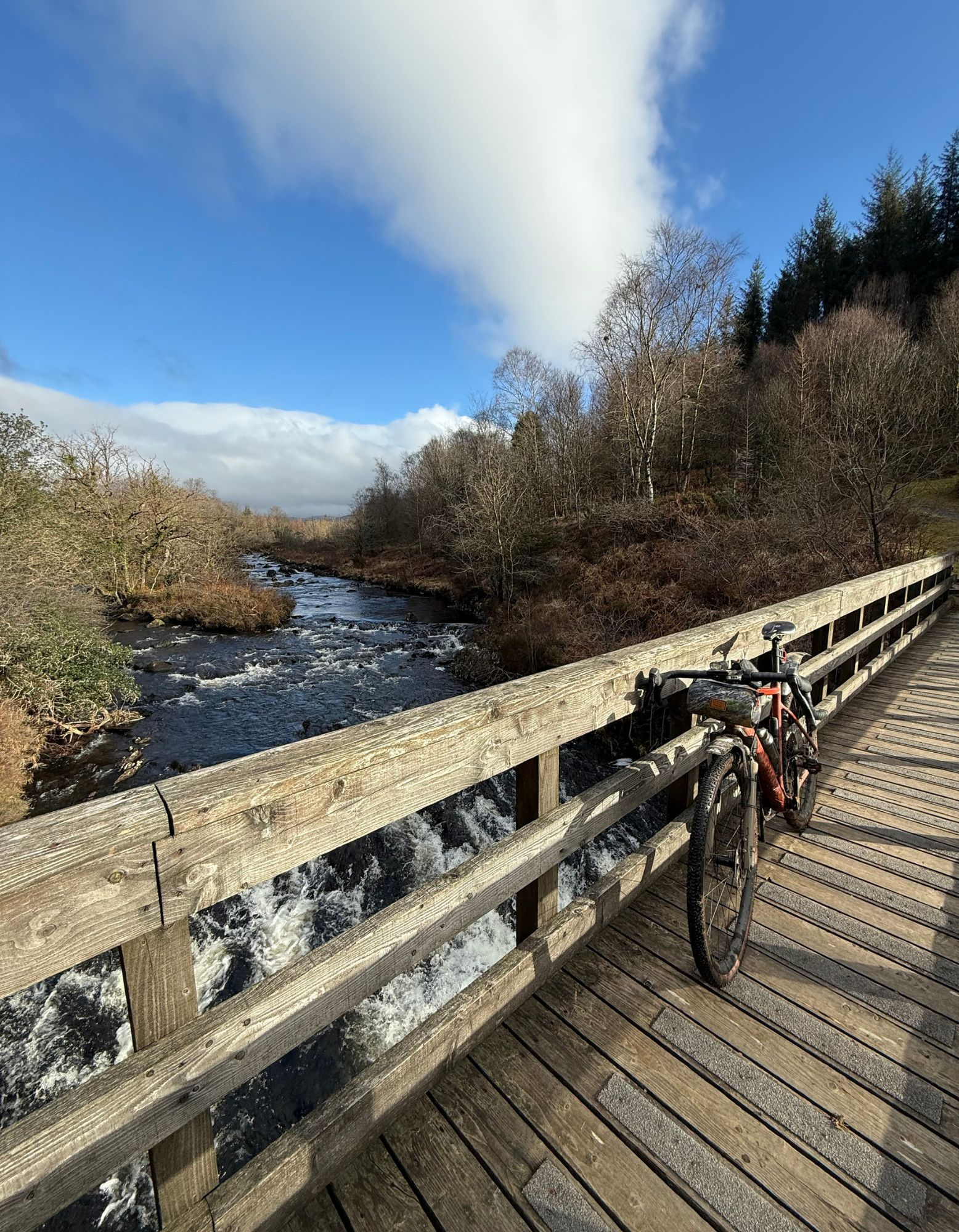
Kilted killing spree acknowledged, drop down onto the gravel track through a short section of woodland to the Wriggly Tin Cafe and Honesty box bothy at Glenhead. Then it’s time to thunder across the wooden sleeper bridge and tackle the main climb of the route. Don’t be too scared though, as while it starts relatively rough and steep the surface soon smoothes out to less lumpy gravel and the gradient eases to an average of around 10%. The mountain landscape (the Merrick to the north is the highest peak in the Southern Scottish Uplands at 843m) unfolding around you will hopefully take your mind off your legs and lungs too.
The air and light quality as you ease over the summit of the pass is equally as breathtaking as the true sense of wilderness you get looking across Loch Dee to the hills beyond. It’s also the heart of the Galloway International Dark Sky Park zone due to the lack of light pollution in the area, so well worth a trip back up after nightfall.
Loch Dee - Clatteringshaws Dam 38 - 51km
You top out on the long climb just before Loch Dee comes into view, but don’t relax totally as the fire road around the southern shore still has a few rises and falls to go. There are also plenty of perfect picnic spots here though, so treat yourself to a scenic snack break as a reward for getting over the half way point in distance and well past it in terms of effort.
After following the first few km of the River Dee on its journey to the sea at Kirkcudbright you’ve got another signposted route choice at 44.5km. Heading straight on down the valley to the south takes you up and over to the Black Loch on fire road and following a reversed version of the 7 Stanes ‘Big Country’ loop from Glentrool for an overall distance of 63km.
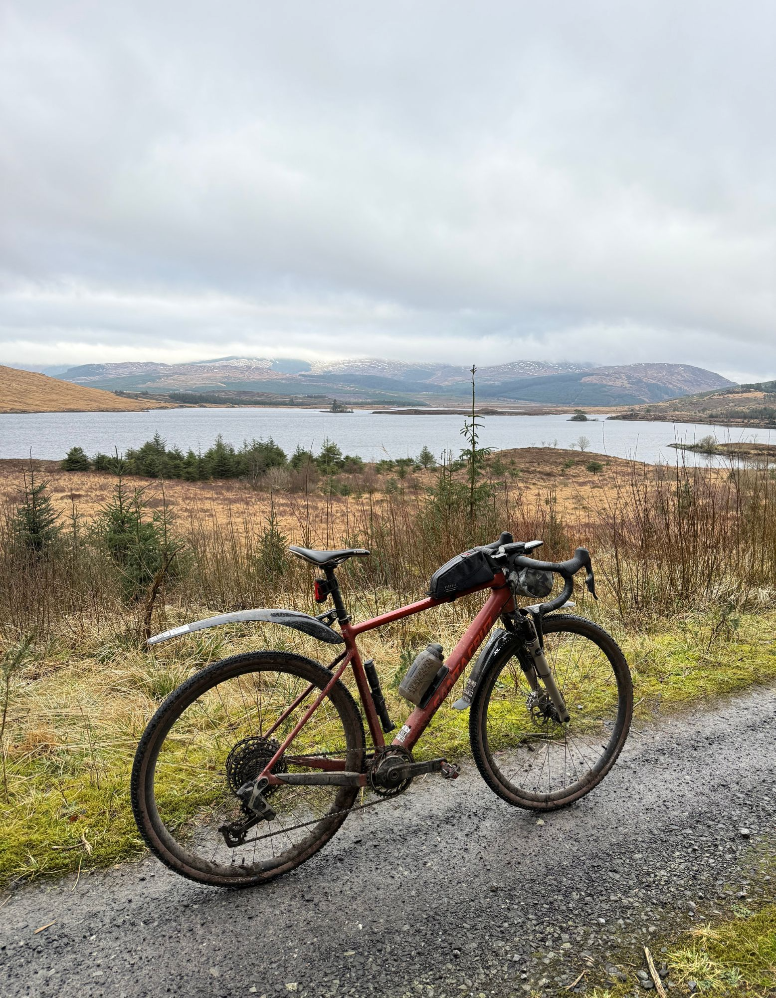
Staying on NCR 7 and curving left means gravel will soon become a skinny tarmac ribbon that rolls you round to the shores of Clatteringshaws Loch. As you pass the NCR 7 marker post you’ll be able to see the observatory on the far bank too, although you’ll need a telescope of your own to spot whether the sign says it’s open yet so it’s best to check online before making the diversion. Then it’s a roll round the bottom corner of the ‘Loch’ to the giveaway concrete dam.
Clatteringshaws Dam - Craigdistant 51 - 64km
To be totally honest the original plan from here was to route down the Old Edinburgh Road through the forest at this point. But ten metres of dodging baby wipes and other filth into an increasingly impassable overgrown swamp suggested the glory days of the original coach road to Stranraer are now long gone. That meant a reluctant diversion onto the main road south for 4km. But with a gentle downslope, gorgeous Moffat Water valley views and just one passing car in 5 minutes it was actually no stress at all.
Diving off tarmac and back onto gravel always feels great though, especially as the gradual climb up to the Black Loch takes you between the official 'Red Deer Park’ and ‘Wild Goat Park’, and into eagle, osprey and peregrine territory for an extra wildlife fix. If you’re feeling arty you can cross to the far side of Black Loch to the 10m high piled tile ‘needle’ structure that you can look through the ‘eye' of across the water. This is also where the 63km ‘Big Country’ route rejoins our loop, and a few hundred metres on you can also divert to the Grey Mare’s Tail waterfall, which at 60m drop is one of the UK’s highest falls.
A break in the trees as you climb will also reveal the granite obelisk (pointy stone) of the Murray monument, which commemorates a local shepherd boy who became a self taught academic sensation and ended up a lecturer at Edinburgh University. If you’re more into spicy singletrack than scholars keep an eye out for the signposts for the Kirroughtree Black Craigs MTB route, complete with its iconic McMoab slabs and ridge rides. Our drop bar focused route keeps you on fast rolling gravel fire road, past the mirrored serenity of the Loch of the Lowes, before a final upslope towards Craigdistant Hill with its panoramic views south and west over the Machar Hills and Wigtown Bay.
Craigdistant - Kirroughtree 64 - 70km
Don’t get too fixated on the views as you drop down into the forest though, as there’s a couple of decent corners that’ll make you part of the scenery yourself if you don’t concentrate. The track also stops at the ‘main’ road, so be careful in case you actually overlap with a car on the km of road before you double back left onto a tiny back road. This wiggles down through the woods of Bargaly Glen and again lack of traffic means it can be slippery in the wet so don’t go mad. It becomes a rougher farm track after the gate where you might have some local Galloway cattle for company too. While the ‘road’ continues over a bridge, follow the MTB diversion signs to stay on this side of the river, continuing through the farm and back into Kirroughtree Forest.
From here you can just go straight on down the track to the cafe for a km if you’re desperate for a cuppa. However, diverting onto the Blue trail gives you a final wiggle of singletrack and takes you over the excellent big bike wheel bridge to finish with a flourish.