


MAY 2025
53°22'38.6"N 1°56'5.8"W
We’re back in the Peak District just south of Polaris HQ again this month. Taking you on a slight twist of an absolute classic loop of rowdy, rocky, technical trails with stunning views and a great halfway stop in Castleton. Kinder Reservoir, Jacob’s Ladder, Holywell Cross, Mam Nick, Cavedale, Broken Road, Rushup Edge, Roych Clough, Mt Famine and Coldwell Clough. If you know the names you’ll realise this is a true ‘greatest hits’ selection and if you don’t you’ll be sure to remember them once you’ve ridden them! And if you’re unsure the full loop is for you then there’s a natural short circuit option at 17km which cuts out 10km but only loses you Castleton and Cave Dale.
POLARIS JACOB'S CRACKER
41.5KM, 1,440M VERTICAL
Start and finish point - Hayfield is around 50km west of the M1 near Sheffield and south east of the M60 at Stockport Sports Village. There are train stations at New Mills (5km from Hayfield) and Glossop (7.5km from Hayfield) too as well as trains direct to / from Edale a few 100m off the route at 13km in.
The GPX file for the route and a Strava Fly Through animation are all on this page as a visual guide. However, for a live impression of the terrain, stunning scenery and some extra commentary be sure you watch Guy’s video. Don’t expect it to always be as dry and sunny in the Peak as they got that day though!
Stops & shops
There are public toilets, shops and pubs in Hayfield where you start / finish, and supermarkets and a bike shop in Glossop 7km north.
En route there’s a seasonal ice cream vending machine at Upper Booth (10.2km).
Edale is just north of the route at 13km with a cafe, shop, toilets, car park and pubs.
Castleton (22.5km) is just over halfway with a selection of cafes, pubs, shops and other facilities.
There’s a cafe at Blue John Cavern (25.7km) above the Broken Road at but check opening times before you rely on it. Otherwise, Castleton is the last fuelling stop until the finish, so stock up on snacks accordingly.
Watch out for
We need to be clear that if you don’t like rocks and fast/technical descents you’re really not going to enjoy this route so go and try one of our easier options.
As well as the general high level of technical skill required, Jacob’s Ladder and Cave Dale descents are particularly long and challenging. Grip reduces dramatically and risk increases accordingly in the wet too, particularly on Rushup, Roych Clough, and Mt Famine descents where there are large sections of exposed rock slab.
Rain - and general bad weather - are something of a signature of the High Peak too so check detailed forecasts and then level up with the clothing you take just in case.
Finally, this whole area is understandably very popular with riders and ramblers so expect it to be busy all year round and potentially heaving in holidays. Castleton and the Broken Road are a social media / selfie hotspot now too so make sure you do your hair nice.
Route information
Hayfield to Jacob’s Ladder 0-7km
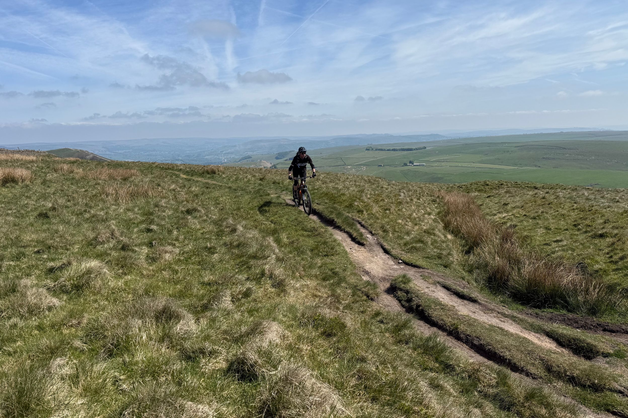
There are pay and display car parks in Hayfield next to the main road but the GPX starts near the Sportsman’s Arms on Kinder Road for a convenient free parking start and pub finish. The High Peak wastes no time in asserting dominance with a steep, loose rocky bridleway climb straight away. This eases slightly into a rutted grassy climb as Kinder comes into view and then it’s rolling multi track fun, before the slightly rocky singletrack descent to the corner of Kinder Reservoir.
There’s a steep cobbled descent that can be slippery in the wet and then a short sharp rocky climb up to the road. It’s worth noting that this road comes straight up from the Sportsman’s so if it’s wet and the grass climb is likely to be a slog - or you just want an easier start - then short cut to here.
You can’t dodge the next long grassy climb up to Broad Clough, so take your mind off the effort with the fantastic view of the Kinder Scout ridge on your left. A ribbon of singletrack tight against the wall takes you through a gate and then under the nose of Kinderlow End. At this point be sure to follow the feint track straight ahead that drops you down boringly to Oaken Clough bridleway. Otherwise, you might accidentally follow the really fun rising technical singletrack footpath that we did in the video which would obviously be a very naughty thing to do.
However you end up on the main climb up to Jacob’s be prepared for a battle with leg buckling gradient and random rocks as you claw your way up to the cruel double summit with its ‘bonus’ kicker. We promise the reward is worth it though.
Jacob’s Ladder to Edale 7-13km
If you’re expecting a big reveal of upper Edale as you roll into the descent you’ll need to be patient as the first section is actually a deep ditch with a cheeky drop off that needs your full attention. You’ll fire out of that into an awesome natural amphitheatre opening, but again, the mix of raw rockery and cobbled ‘path’ isn’t something you’ll want to take your eye off. Especially if it’s wet. Keep your speed controlled too as the gradient takes a while to slacken off and when it does, multiple line options down to the gate will keep you on your toes.
Through the gate, the chaos gets concentrated into a meter of rocky, grassy, drop off infested trough which hooks round a tight switchback into a second leg of free range geological evil, with dry stone walls tight either side making sure there’s no easy option.
Once your arms and nerves have recovered, dip through the ford and then enjoy the relaxing roll down the broad track towards Upper Booth. If it’s summer and you’re hot don’t miss the pop up ice cream vending machine in the farmyard to the left just after the gate. Even if you’re not screaming for ice cream the next couple of km of streamside road are a great place to fill your face ahead of the next climb. Just be careful of the tight corners and any traffic coming the other way. We don’t actually go through Edale, but with pub, parking, camping, and a cyclist friendly cafe it’s a great spot to stop, or even start the ride if you’re coming from the east/south.
Edale to Mam Nick 13-17.6km
If you’ve got one of those fancy GPS unit’s that tell you how long the next climb is, prepare for 3.5km to flash up as you cross the gorgeous little gorge of the River Noe. The first 500m is on road before you go up through the little gate on the left and begin the diagonal traverse up to Hollins Cross. Don’t bother rushing this either as both gradient and technicality gradually increase as you winch towards the ridgeline.
Prepare for an audience in the final few meters too, as the broad stone flagged path from Hollins Cross up to Mam Tor is very popular with hikers from stern faced stompers to meandering school parties. So ‘be nice, say hi’ and expect some interruptions to progress. Don’t worry about the final grass wall ahead of you up to the ancient fort of Mam Tor though, as the bridleway peels off to the right at the base. It then sidles off along the fence line before a fun little singletrack run down to the road at Mam Nick. This is the obvious point where you can start heading home rather than carrying on to Cave Dale and Castleton, saving yourself 10km but meaning there’s no more supply stops until the finish.
Mam Nick to Castleton 17.6km-22.5km
Otherwise roll down the road - taking the footpath straight down and then across would, again, be very naughty - and hook around left and then right at the two T junctions. Then watch for the misleading footpath sign onto the broad gravel track that’s actually a bridlepath. Look for another gate just after the left kink which starts opening the jaws into Cave Dale. If you’ve already reached your steep and rocky limit with Jacob’s Ladder then there’s also the option to stay on the big track and drop down Dirtlow Rake and Pin Dale instead. This is still a really fun and slightly less risky way to get into Castleton too, so if in doubt, check it out.
If you’ve committed to Cave Dale though, you’ll start wondering what all the fuss is about on a gentle grass valley descent with a gradually increasing rock count. Once it starts getting really chunky though you’re about to roll through the gate and into the real teeth of the beast. It’s a proper savage too, with a sprawling mess of rocks that are still wet on the driest days, making it a real challenge to navigate without killing a tyre or dabbing out. Survive that though, and the end game is great fun. With the ruins of Peverill Castle tower literally towering over you as you finish with a dive down a final rocky gulley to the bottom gate. Now pick your favourite pub or cafe in Castleton for a rest, because you’ve earned it.


Castleton to Coldwell Clough 22.5km-36.5km
Belly full and brakes cooled down, it’s time to climb up the long but comically wonky ‘Broken Road’ back up to Mam Nick. Marvelling at the folded, seemingly melted sections of old Tarmac that look more like lava than a road while trying to dodge everyone else who’s making a social media pilgrimage to its curious curves and cracks. Keep tapping on past Blue John Cavern, which is the last chance for a cafe stop if it’s open, and then retrace your road steps back to Mam Nick.
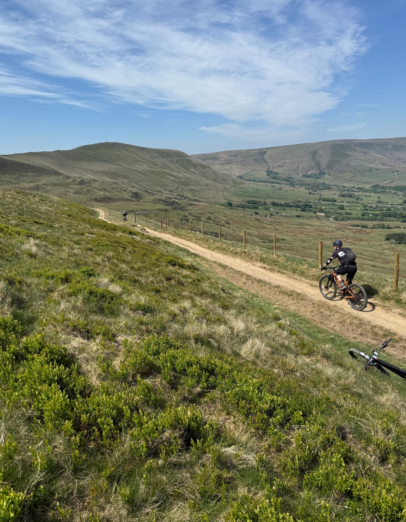
This time though, hook back at the top of the wood and carry on winching up the parallel single tracks of Rushup Edge. The reward for climbing up to the bronze age barrow of Lord’s Seat is a gloriously long descent first on grassy singletrack and then a broad rocky trail to the road.
Stay in the little permissive bridleway strip by the wall to avoid the traffic and then turn right towards Roych Clough on more fast, rocky track. Don’t get too carried away with your speed though as rock size and technical challenge ramps up dramatically - especially if it’s wet - as you curve right and drop into Roych Clough.
It’s a balancey, bobbly sort of grunt up the far side but then a steady spin up until the last couple of hundred meters to South Head where it gets fighty again. That’s potentially the last real climb though, so consider how your legs are feeling as you hook around Mount Famine on a fast rock and then farm track descent to Coldwell Clough cross roads.
Coldwell Clough to Hayfield 36.5km-41km
If you’ve already watched the video then you’ll know that Ryan’s roll around on the rocks down Rushup Edge meant we took the right hand turn through the small gate for the classic Coldwell Clough finish. It’s a really good run too, with lots of parallel, rock filled ruts to challenge your choices and steering skills before a fast and fun run out. The local legend option though is to drop further down farm track, onto the road, and then double back at 38km. Your legs won’t thank you as the grassy field is a stiff climb even in the dry and a proper slog in the wet. The steep technical drop into the woods from the top is an absolute treat that’s worth the effort if none of you are wounded though.
Either way you’ll get to the gate at the top of the ‘Campsite Descent’ which gives you the final rocky trail rush back into Hayfield for well deserved tea and medals.
