


JULY 2025
54°20'28.4"N 3°1'27.3"W
This month we’re taking you to the Lake District which is undoubtedly most famous for its rugged and mountainous pure MTB trails. However, we’ve done several hardcore fat tyre routes recently so the intention was to take on the gentler scenery, round Grizedale forest and Windermere with a gravel route. Typically for us though, things got a bit rowdier and rockier than expected on several climbs and descents. With that in mind we’ve decided to split this month’s route into two options.
The XC MTB/ Big Gravel route we’re mostly talking about here, and a gentler ‘pure gravel’ route which we’ll drop notes about and is available as a separate GPX file. Either one can also be split into 17 and 28 km west and east loops if the full 45km sounds like too much.
Whichever you choose you can expect a mix of stunning views of the Lakes and mountains, tranquil forest trail riding, and as little back road action as possible. The Grizedale forest sections also include several bonus man-made singletrack options if you get bored of cruising on kitty litter.
*Title photo courtesy of Graham Atkinson
POLARIS GRIZEDALE GRAVEL - XC MTB OR PURE GRAVEL ROUTES
45.9/49.9KM, 1,232/1,155M VERTICAL
Start and finish point - The route starts and finishes at the Grizedale visitor centre as there’s a full set of facilities including a bike shop with hire. There are shorter waymarked bike routes, walks and a GoApe ropeway to keep others occupied while you ride too. It can be a real fight getting down the singletrack roads to reach it though so you could start at Hawkshead at the north of the loop. Ambleside is a possibility too but the bike path down to the loop is patchy and the main road sections where it doesn’t exist are horrible.
what3words ///eliminate.tugging.runner
This what3words address refers to a 3 metre square location. Tap the link or enter the 3 words into the free what3words app to find it.
For full navigation data download the GPX file and watch the Strava fly through. Then watch our ride video below for a highlights preview of the route.
Stops & shops
There are toilets, an excellent cafe, and a bike shop (with rentals), run by Lake District legends BikeTreks, at the Grizedale Forest visitor centre where you start and finish. The car park is pay and display.
Hawkshead (km) has several cafes and pubs, a Co-Op shop and public toilets.
There’s another pub at Outgate (18km) and a cafe at Wray Castle (20.4km).
Claife Viewing Station (26.3km on the gravel route) has a cafe and toilets, and there’s a pub at Far Sawyer (27km).
Satterthwaite (just off the route at 37km) has a pub too but you’ll lose a lot of height getting to it.
In terms of bigger places, Ambleside (4km from the northern end of the route) has supermarkets, petrol stations and all the other town stuff you’d expect as well as bike and outdoor shops in case you forget kit.
Watch out for
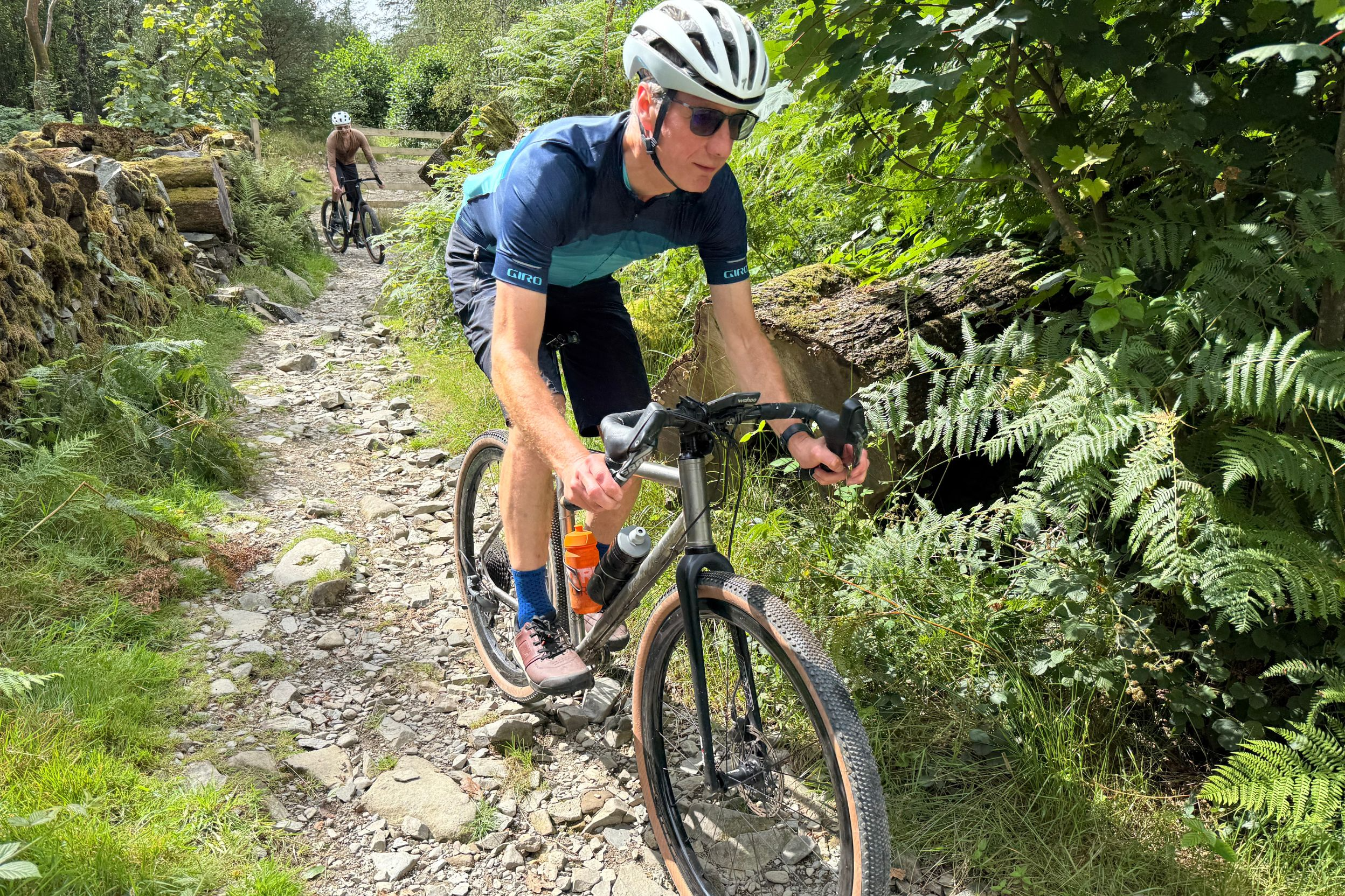
As we said in the intro, if you’re on a drop bar or even a flat bar bike with skinny tyres and not much/any suspension, there are some spicy sections on the XC/Big Gravel route. The first of these is the descent towards Hawkshead at 14.3km and Spicka Coppice at 18.5km has some chunk too.
The lakeside walk along Windermere (21-25km) is likely busy at weekends and holidays so ride responsibly.
The climb up and over to Far Sawrey (25-27km) has some proper challenges on the way up and some blunt water bars on the way down.
Low Dale Park (34km) was properly overgrown with some tech trails style sections when we rode it in late July too.
Then finally the descent to the visitor centre at 45km is a proper rocky roller so don’t go flat out or you risk flatting out.
On the bright side, despite this being the Lake District and therefore likely to be wetter than most of the UK, the only real exposure to weather is loop out onto Parkamoor at the start which is easy to miss out if it’s really persisting it down.
Route information
Grizedale to Parkamoor 0-8km
Starting from the Visitor Centre you can either walk your bike through the cafe and wiggle round to the bike shop where the trails are signposted from and follow the orange arrows for the Silurian trail. Or just use the bridleway alongside the south wall of the centre to get to the same exit point. Climb away from the visitor centre on the broad trail and then peel left downhill on the fire road, following the orange signs as they curve round and begin the first long climb through the forest. At 3.8km, turn left off the Silurian trail, continuing to climb on fire road until a right onto singletrack at around 4.6km.
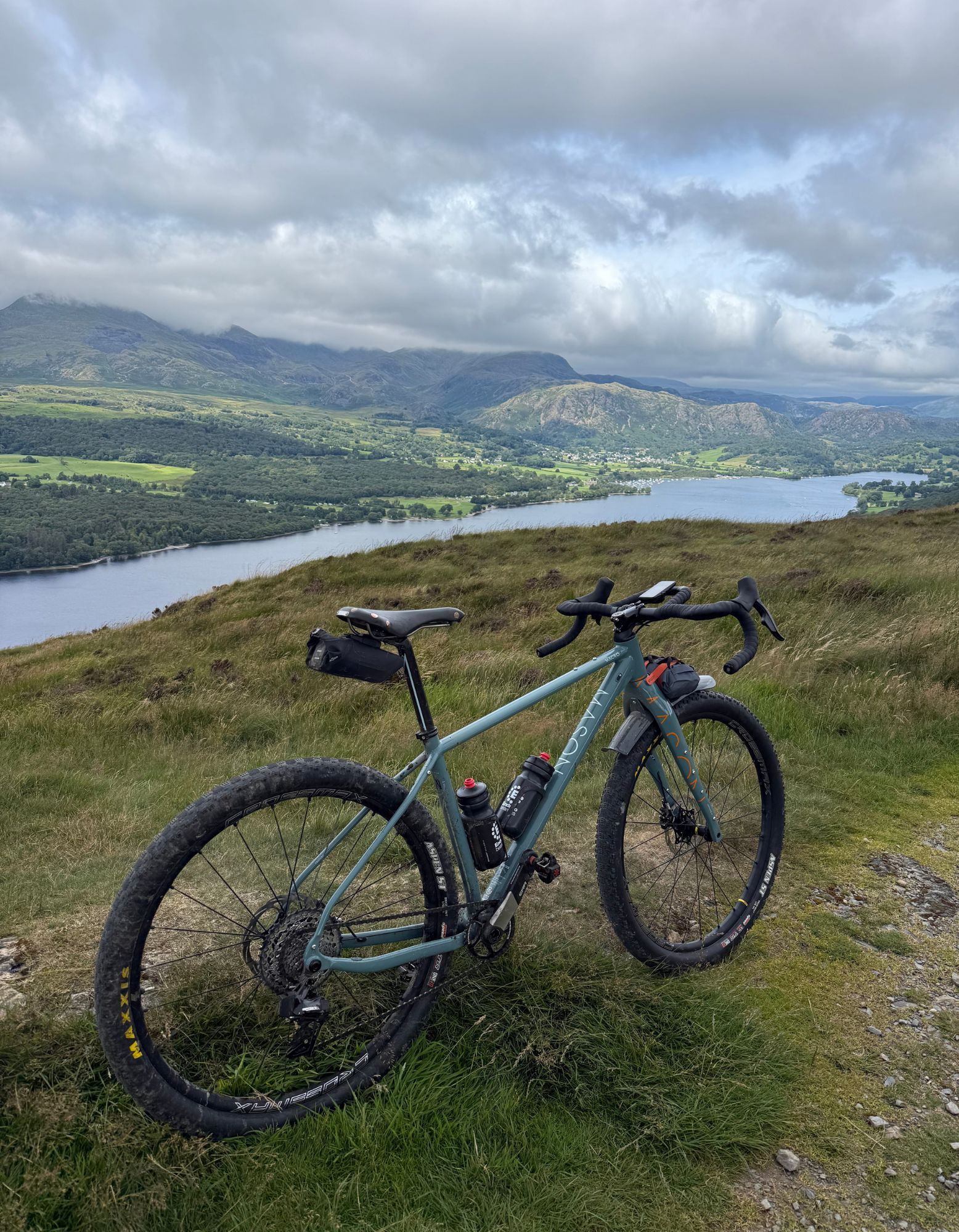
This brings you out onto Low Parkamoor on a rocky double track across the open fell. You’ll start descending with an awesome view over Coniston Water and the Old Man of Consiton beyond. Don’t get too carried away with the downhill though, as you need to double back at 6.5km to climb past ‘The cottage in the clouds’ at Low Parkamoor up to the 300m high view point. This is a great spot to have a snack while taking in the stunning scenery including the steamers and sailing boots on Coniston Water below and the rugged rocky flanks of the Old Man opposite.
Parkamoor to Hawkshead 8-16km
Drop down north to the edge of the forest, and follow the roller coaster singletrack to rejoin the red MTB trail and the orange Silurian way signage at the fire road (9km). The GPX will keep you on the fire road as it skirts in and out of the trees revealing new windows of the view west as you go. If you’re in the mood for a more technical track though, take the various segments of red MTB route that loop off and back onto the fire road. It’s proper old school rocky, narrow ribbon trail not modern berms and jumps style trail building, so it actually feels really natural and in keeping with the rest of the route.
You’ll climb gradually until the fire road tops out at the 12km point and then starts swerving gently downwards. At 13.2km you can either stay on the fire road around the long lazy switchback or cut straight down the single track. Now, turn sharp north on the fireroad to start the descent towards Hawkshead. This is a fast, sweeping section of trail so keep your eyes peeled for the signed bridleway turn off into the trees. This starts relatively mellow with a little stream crossing down to a gate. After that though, the rocks get increasingly large and it was wet in places even in the scorching summer so don’t expect much grip from the notoriously slippery Lake District geology.
Even if you manage to ride the whole descent make sure you heed the ‘please dismount’ signs and get off and walk the last section of path into the pretty whitewashed village of Hawkshead.
You’re now a third of the way round and at the only shop en route so worth grabbing snacks if you need them. We’ll let you decide whether you’ve already earned a pint or a pot of tea at the various pubs and cafes in this gorgeous little village.
Hawkshead to Windermere 16-21km
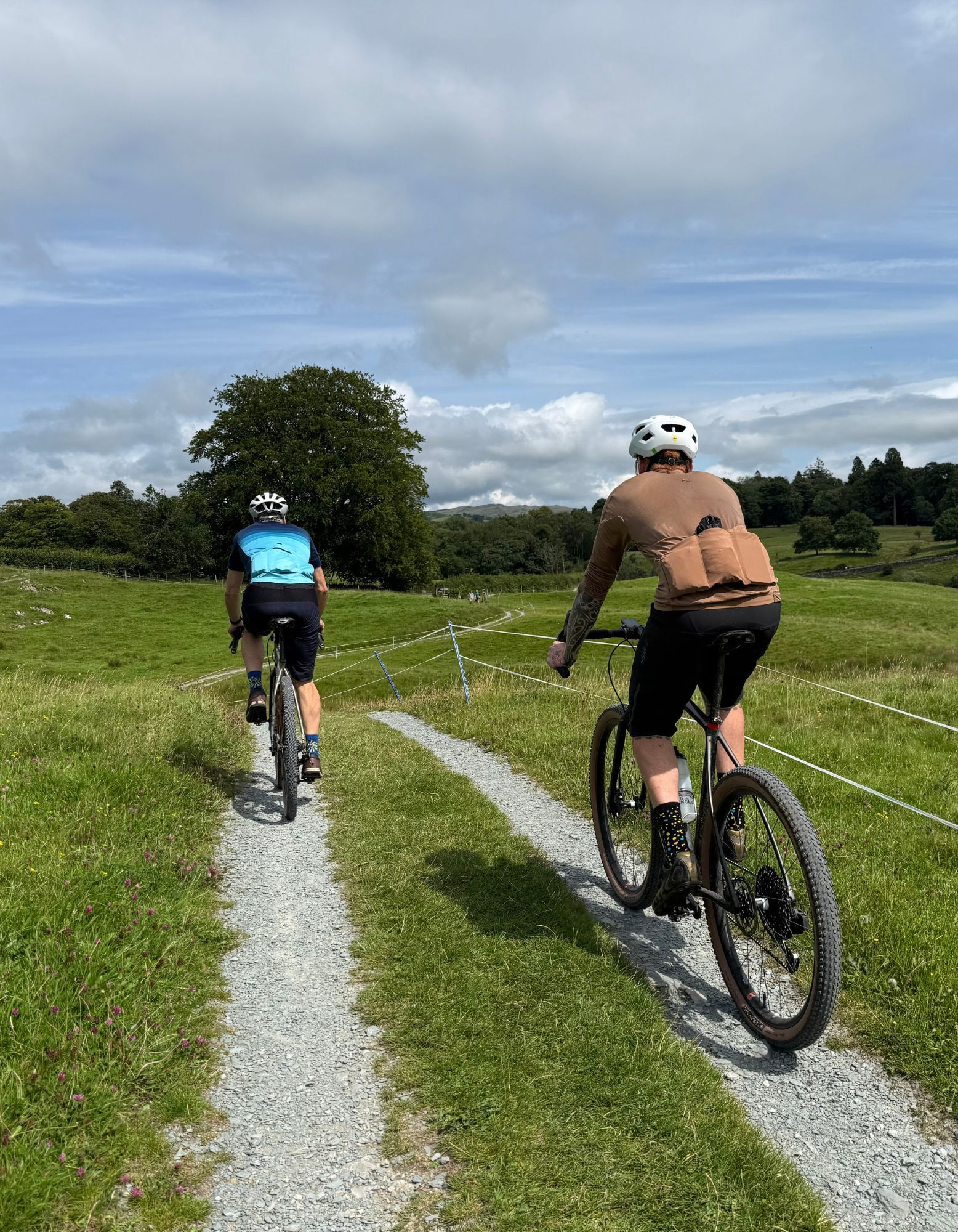
Leave Hawkshead on the cycle path that takes you down the side of some houses and then out into the meadows over a small footbridge to Scar House Lane. This section uses a lot of the relatively newly gravelled and signposted multi user route sections that have been created in the Lakes. That’s great for keeping you away from traffic but they are narrow and often quite windy so ride carefully so you don’t startle walkers, horses or bikes coming the other way. Look for signs to Wray Castle to help you navigate and expect to open and shut a lot of gates too.
There’s a short section of quiet road to Loanthwaite before you take a gravelled and gated trail across to Outgate where there’s a pub and another short section of potentially busier road. You’re only on it for about 100m before peeling right onto the bridleway down through Spicka Coppice. This is a gorgeous section of ancient woodland with an arch of trees forming a tunnel at the exit, but make sure you pay attention to the trail itself too as there’s some big rocks that’d love to pop the tyres of careless riders.
Now you cross a small section of open heathland on a winding double track, with the nature reserve of Blelham Tarn to your right. Another short section of road with a sharp ramp up takes you to the gatehouse of Wray Castle where the National Trust have a cafe. The castle itself is being renovated at the moment but there’s parkland to explore complete with a picnic area and bike parking. Just beyond the gatehouse you’ll see a gate marked with the National Cycle Network 6 sign that’ll take you down to the western shore of Windermere.
Windermere to Far Sawrey 21-27km
This section is by far the most mellow - well to start with at least. However, it’s also likely to be the most crowded with ramblers, tourists, dogs, toddlers, pottering pensioners, and all the other things that pay no heed to oncoming bikes. So while it’s a lovely fast roll on a quiet day, go very carefully in summer or any holiday time. That’ll give you some time to take in the gorgeous views across the lake with its boats and Bowness on the far side, and the little beaches and coves on this side make great picnic spots.
The easy breezy ride stops abruptly if you take the XC/Gravel route and peel away from the lakeside at 25km. What starts as a relatively gently singletrack, soon degenerates into a proper fight with both gravity and geology. This includes multiple sections that will confer god status on a gravel bike and still be a significant challenge on an MTB. Each time you think you’re done there’ll be another section lurking round the corner to empty your legs and lungs again, so big kudos to anyone who gets to the top without dabbing. The rewards - besides a big sense of achievement - are some lovely views over your shoulder across Windermere as you climb, plus a great double track onto rocky farm track descent down to Far Sawrey on the far side.
If you’d rather dodge the dance with traction devils and bottom gear grinding then the ‘pure gravel’ option couldn’t be more different to start with. Simply continue along the lakeside with potential to stop at the Claife Viewing Station (26.3km) for coffee and cake overlooking the Ferry House (think Beatrix Potter not Dover). You will still have to put in a dig on the road to get up the short steep slope after that, but from here you can hook back round to the pub at Far Sawrey or short cut down the quiet road through the woods to High Cunsey.
Far Sawrey to Low Dale Park 32-34.5km
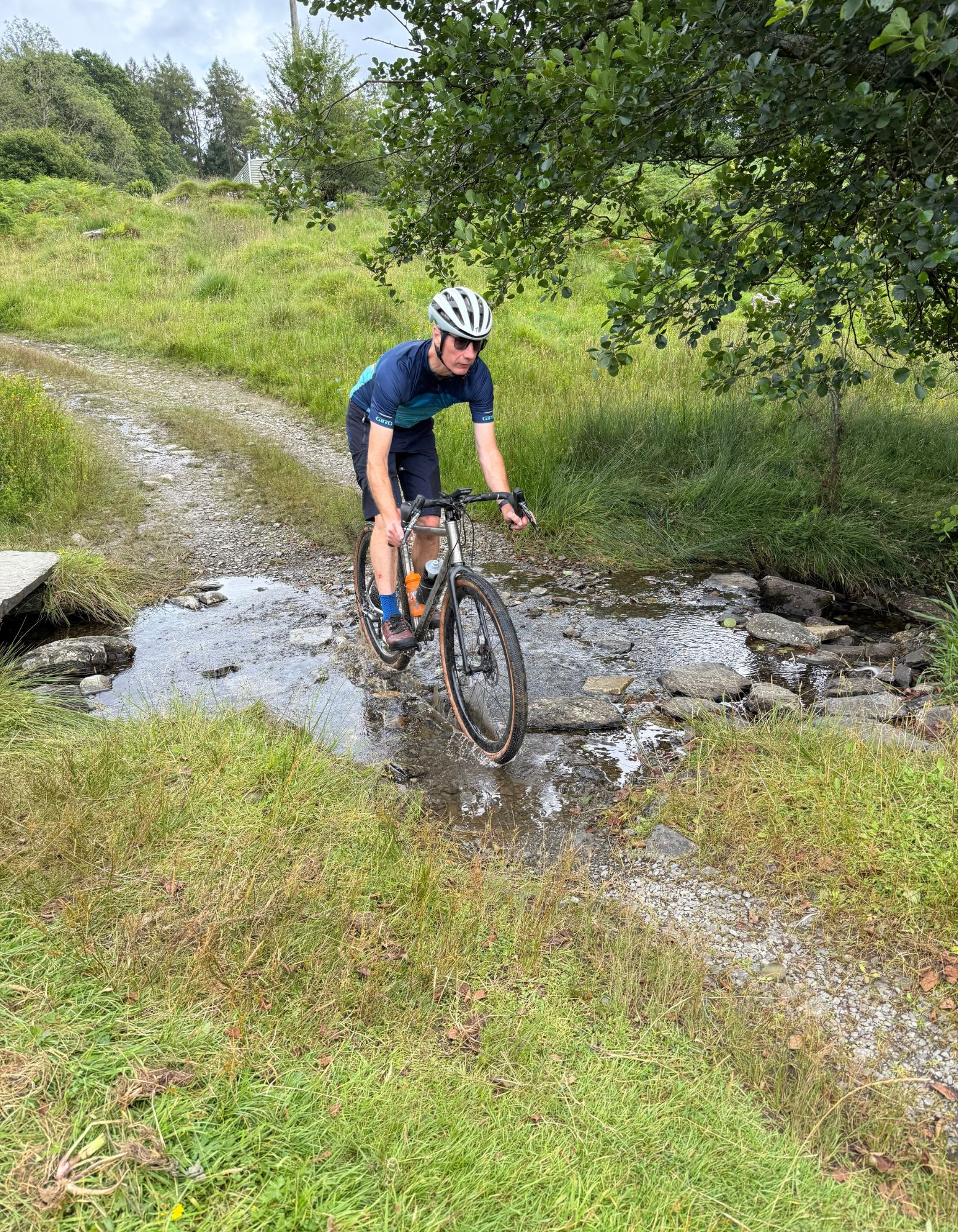
After a potential pint and maybe a tickle on the defribilator to revive you after the climb - only joking, DO NOT muck about with medical equipment, just make a note of where it is in case you or someone else needs it - roll down the road through the tiny hamlet of High Cunsey to Cunsey Bridge. Turn right into the woods on the singletrack straight after the bridge for a lovely bit of stream side tranquility. It’s actually flat too and once you’re past a potentially soggy start it’s all rock based so should ride well all year round. Popping out onto the road you turn left uphill, trying to take your mind off the gradient by appreciating all the wonderful colours and nature sounds in the woods around you. This is a good spot for a rolling snack and a swig of drink too as you’re about to need that extra energy if you follow the XC/Big Gravel route.
This kinks back off the road at 32km climbing up through the relaxingly pine scented sawmill at Black Brows Close. The gradient is anything but relaxing as you crank up to Bleaberry Fell though, and it looks you dead straight in the eye all the way up which doesn’t help. The V cut view waiting at the top was so green it was like something out of Jurassic Park when we rode it in July, and the first section of singletrack descent is a fun blast without any lurking traps even when it’s overgrown.
Stopping at the fire road T-junction - in high summer it’s definitely confusing where to go next - there’s a sign in the bracken just to the left of straight ahead. Follow it down a singletrack to a crossing of paths, where you take the right across a short section of open scrub to a big deer gate. While we promise that this is a legitimate bridleway, there’s some proper trials style rock features and a stream to cross in the next section of woodland. Theoretically the route goes hard right upwards after the gate in the dry stone wall to run alongside the stone wall. That’s what we did and for legal reasons that’s what the GPX does too. We spent most of the next 300m trying to find a rideable path through the head high undergrowth, fallen trees and random boulders (watch the video for the full comedy). So, if you were to ‘accidentally’ go straight on at the gate and follow the track that loops round to rejoin the official path you’d have a much easier time and we doubt anyone would care. Either way you’ll roll down through the ford to the scattered houses of Low Dale Park, ready to re-enter Grizedale Forest.
Low Dale Park to Grizedale 34.5-45km
Again, you’ve got two options here. The first is immediately across the road onto the bridlepath that punches straight up onto the forest. Given what we’d just done and feeling guilty that this was meant to be a gravel route we decided not to risk another borderline unrideable choice. So instead the route rolls a few hundred meters south on the road before turning right into the forest (35.5km) on a steady fire road tempo climb that actually puts you back onto the far side of the Silurian trail again. It’s actually a decent pull all the way up to the 37km of Beacon Crag high point but it’s gentle enough that it doesn’t have to hurt if you don’t want it to. The orange Silurian signs mean that there’s no worries about navigation either. The fire road rises and falls through the wind whispering, bird song filled woods, making the final furlongs pass particularly peacefully. Taking the short diversion to the man-made mindfulness oasis of Grizedale Tarn just after 40km is the perfect chance to fully appreciate the serenity of your surroundings too.
You can short cut back to the visitor centre at 41.5km or carry on round the Silurian trail to the north. Here you’re only a few hundred meters from where we dropped down to Hawkshead and if you’ve had enough of rocky nonsense you can divert onto the road for a smooth roll back to the visitor centre. If you’re happy risking your tyres one last time in the pursuit of silly thrills though, cruise down the fire road until the hook back at 44.3km. From here it’s a proper dice roller of a descent on a gravel bike and a decent descent on a mountain bike - especially if it’s wet and slippery - so go steady at the start as it increases in intensity the further down you get.
You’ll emerge - hopefully unscathed - right opposite the Visitor Centre. Perfectly placed for the cake you’ve undoubtedly earned in the last few hours of riding.
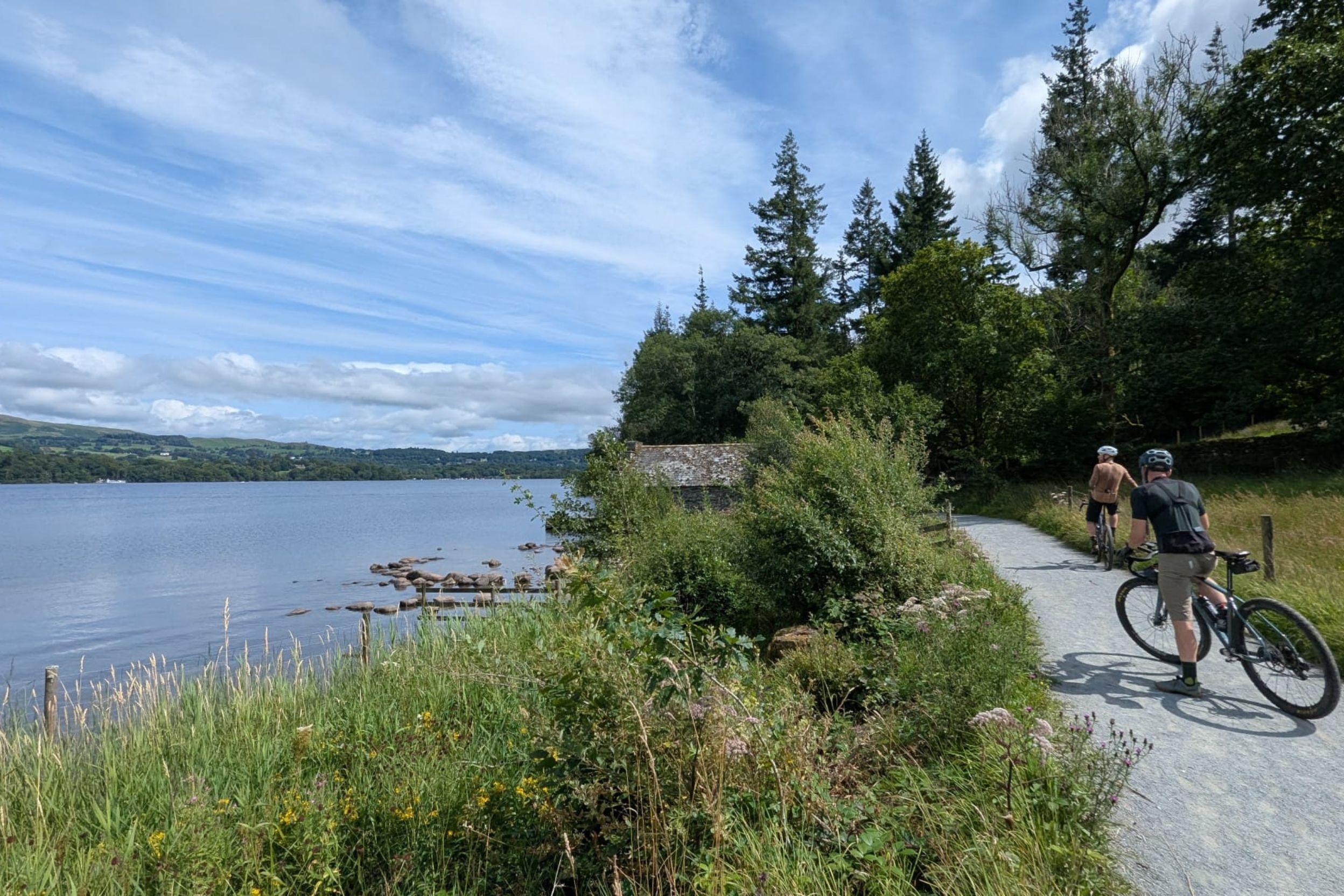
Photo courtesy of Graham Atkinson
