August 2025
54°19'26.5"N 2°31'33.9"W
West of the dales that people have heard of and east of the Lake District, the Howgills are a wonderful forgotten wilderness for true back country adventuring. In fact I hadn’t ridden this classic route for nearly thirty years before we set off from Sedbergh. The incredible, super long singletrack descent from the Calf was even better than I remembered and the return leg is brilliant too. The climb at the start is absolutely brutal though and purely on the basis of gearing this is definitely a MTB route not gravel gallop.
The intensity of the start means 40.2km is likely going to be enough for most riders, but we’ve also included a 24.7km extension loop as a separate GPX if you’re feeling frisky. Whichever you choose you’ll be rewarded with stunning summit views and an incredible sense of remoteness as you head deep into the heart of the Howgills. A truly epic singletrack descent will drop you down to evocatively timeless farms and meadows as you cross to Ravenstonedale. Here you’ll find a couple of posh pub stops to refuel at before a fantastically varied and significantly less strenuous but no less fun singletrack roller coaster ride back to Sedbergh.
POLARIS HOWGILLS CLASSIC
40.2/64.9KM, 1,162/1,653M VERTICAL
Start and finish point - We’ve started the route at Sedbergh as it offers the easiest access from the M6 motorway 8km to the west and it’s got a range of shops and places to stay. If you’re coming from the north east though you can start from Ravenstonedale or get a train to Kirkby Stephen which is just 4km from the loop.
what3words ///decide.tuck.materials
This what3words address refers to a 3 metre square location. Tap the link or enter the 3 words into the free what3words app to find it.
For full navigation data download the GPX file and watch the Strava fly through. Then watch our ride video for a highlights preview of the route.
Stops & shops
Sedbergh has a range of shops, pubs, cafes, delis, a pharmacy and toilets.
The nearest petrol station is Killington Lakes services on the M6 9km to the west though.
Once you’ve headed out of town you’re running on what you brung all the way until Ravenstonedale at 24km which has two pubs.
There’s nothing directly on the trail on the way back either, although the fantastic 400 year old Cross Keys Temperance inn serves food and drink - but not alcohol - at the roadside at Low Haygath (33.5km).
Watch out for
The biggest rider beware aspect of this route is the remoteness - especially in the first half of the ride. Once you’re beyond the Calf, you might not see another soul until you’ve descended to the northern end of the route. Phone signal can be patchy at best too so if anything goes wrong up there it could turn serious very quickly. You’re not far from roads on the way back though so that’s safer if you do need to get help.
While they don’t get as much rain as the Lakes to the west, the Howgills can be a very inhospitable place if the weather is in a bad mood. That’s particularly true of the first climbs and ridges where there’s no shelter from the wind and whatever it’s blowing. That makes taking spare layers even in summer and a proper survival bag / thermal layers / big coat in winter a very wise precaution for comfort and safety. In terms of riding the 6km climb to start is truly brutal, and mostly on grass which can obviously be slippery when wet. Even in our super dry summer there were some soggy sections in several places so get your feet sealed up if you want them to stay dry and comfortable.
Finally, there are lots of gates in some parts of the route so always leave them as you found them. Be careful of sheep or other livesstock, be polite to ramblers and always follow the Countryside Code so we’ll be welcome in this stunningly unspoilt landscape.
Route information
Sedbergh to Winder Fell 0-3.7km
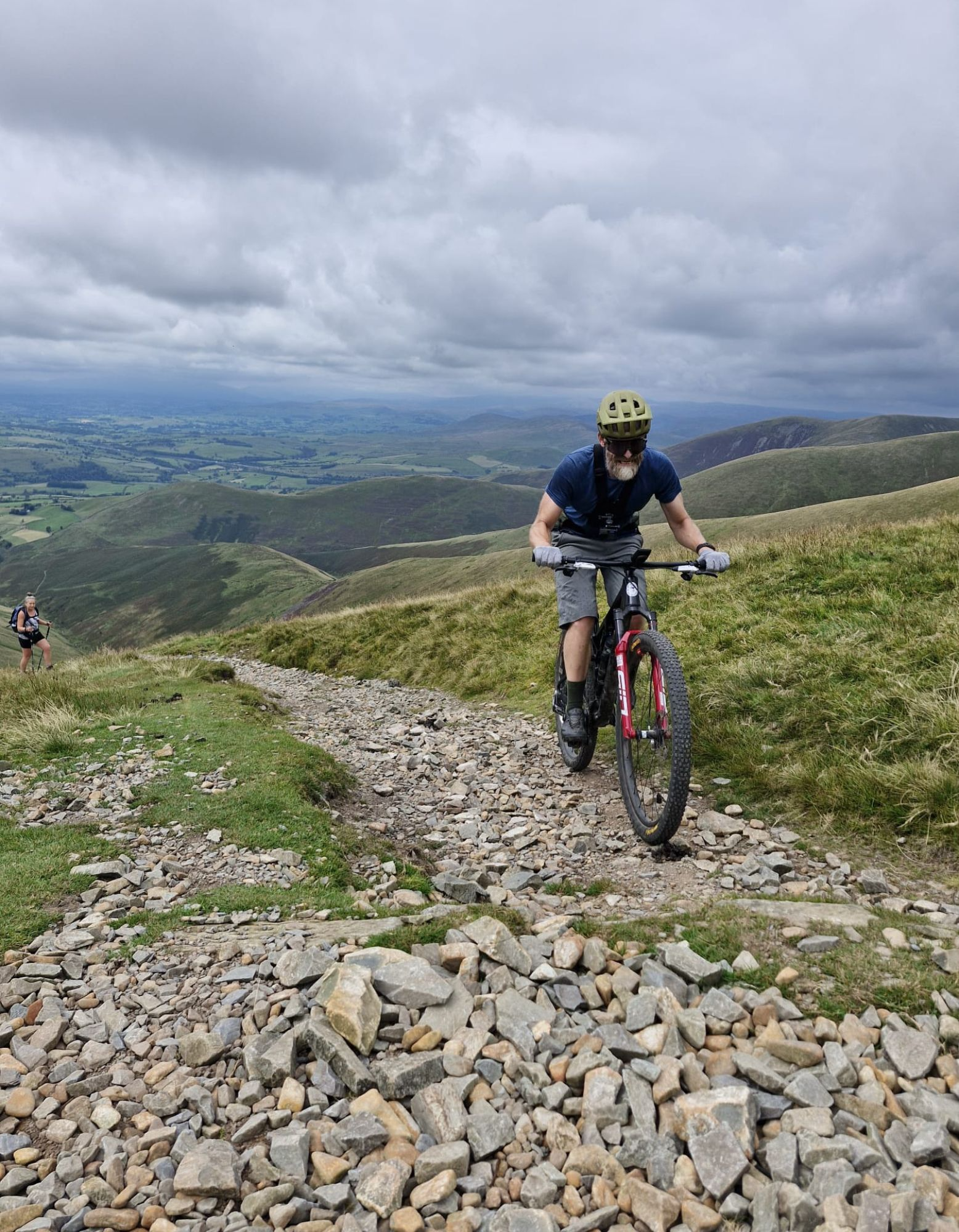
There are a couple of car parks in Sedbergh but the one near the centre has loos if it’s been a long drive. It’s also closest to all the cafes for a pre ride brew and the bakeries to get supplies. The main street is so narrow it’s one way, so either walk to the end past the pretty half timbered buildings or loop round the block on the A684. Either way once you’re past the Dalesman Inn turn north up Howgill lane and follow it round as it curves to the west and leaves town. Enjoy the first couple of km of back lane and warm up as best you can because as soon as you turn up onto the fell things get serious. The start chute up to the gate is lined with dry stone walls and then it’s onto the open fell. In theory the bridleway actually swings left and then right in a switchback but it’s not obvious on the ground amongst a bunch of sheep trail options so you might as well just bite the bullet and start winching straight up the appropriately named Winder fell.
The official route bypasses the summit but the most worn track takes you straight up to the trig point for your first big view of the day over Dentdale and Wharfedale to the east, the glinting waters of Morecambe Bay to the west, and the fells of the Lake District to the north of that.
Winder fell to the Calf 3.7-8.2km
You’ll then drop down a short ‘find a line’ grassy descent to a ‘mind your tyres’ rocky section before climbing again. Again, the official route peels off to cross the flank of Arant Haw, but the obvious track goes straight up what’s effectively a grassy wall. For some reason we decided suffering up that was the best idea, but feel free to be more sensible as you’ll get a very similar view from the top of the Calf. Either way watch out for some rocky patches on the descent across the saddle and gusting wind too if there’s a blow on.
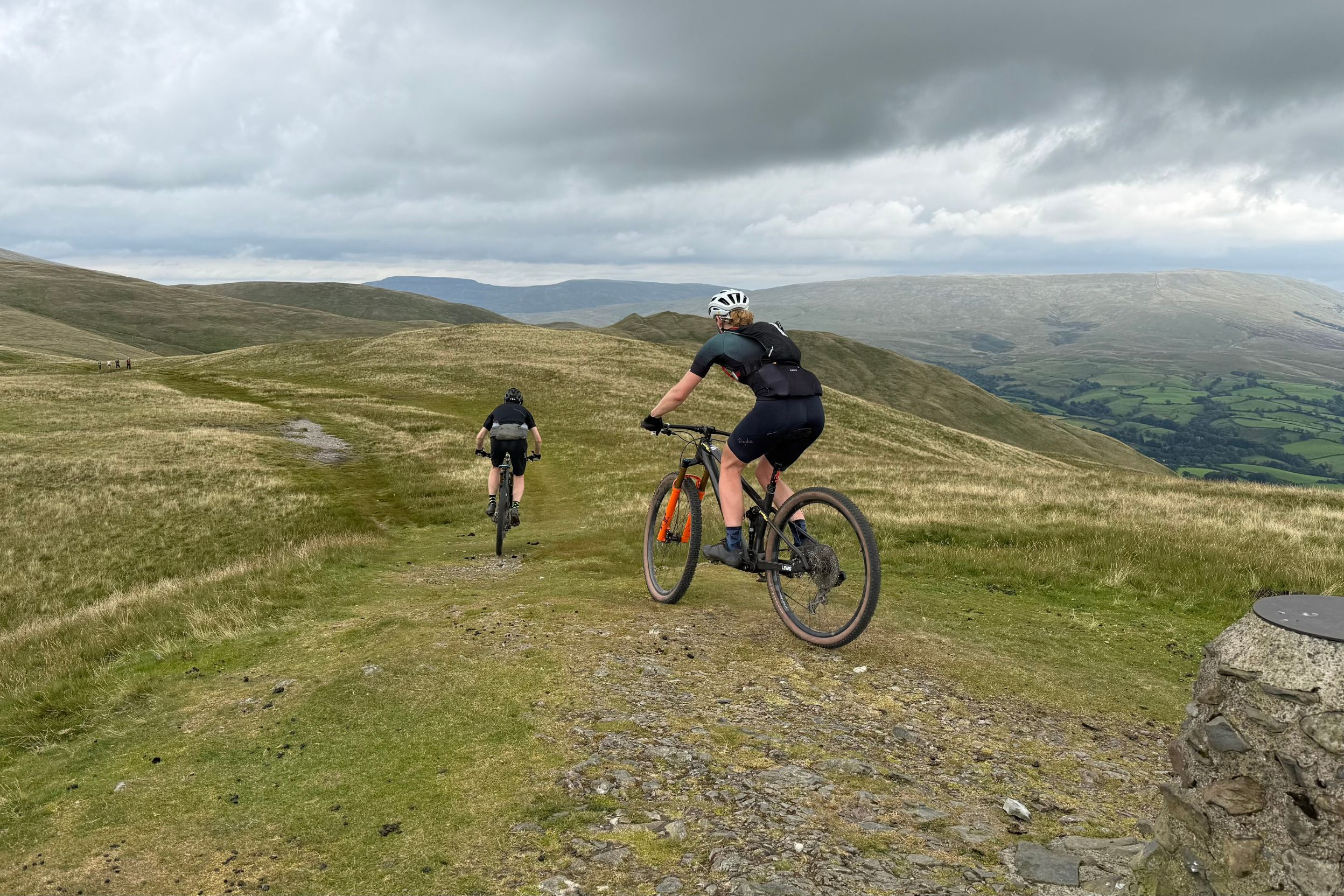
The good news is that the next climb starts off slightly more manageable than Arant Haw before steepening up and then getting rocky and loose up to and round the corner for good measure. The bad news is that the cairn here isn’t the Calf summit, you’ve still got over a km to go to get to that. Happily it’s actually only 2m higher than this point though so while there’s a bit of up and down even the final pull up to the Calf trig will seem like a blessed relief compared to the start of the climb. The broad summit is a perfect spot for a snack and a self pat on the back for getting through most of the climbing in the first quarter of the route too. The views are absolutely fantastic, with the rounded backs of the deserted hills inspiring legendary rambling writer Alfred Wainright to describe the Howgills as a ‘herd of sleeping elephants’.
To keep to the legal bridleway you need to back track down the way you came for about 250m and turn left. It turns out your reward for being good little law abiding citizens will be an indistinct grassy lumpy, slightly upward struggle for about 500m though. So given that this ‘path’ eventually joins the much more obvious, stoned surface of the footpath coming straight over from the summit ‘accidentally’ following that instead wouldn’t be a bad idea.
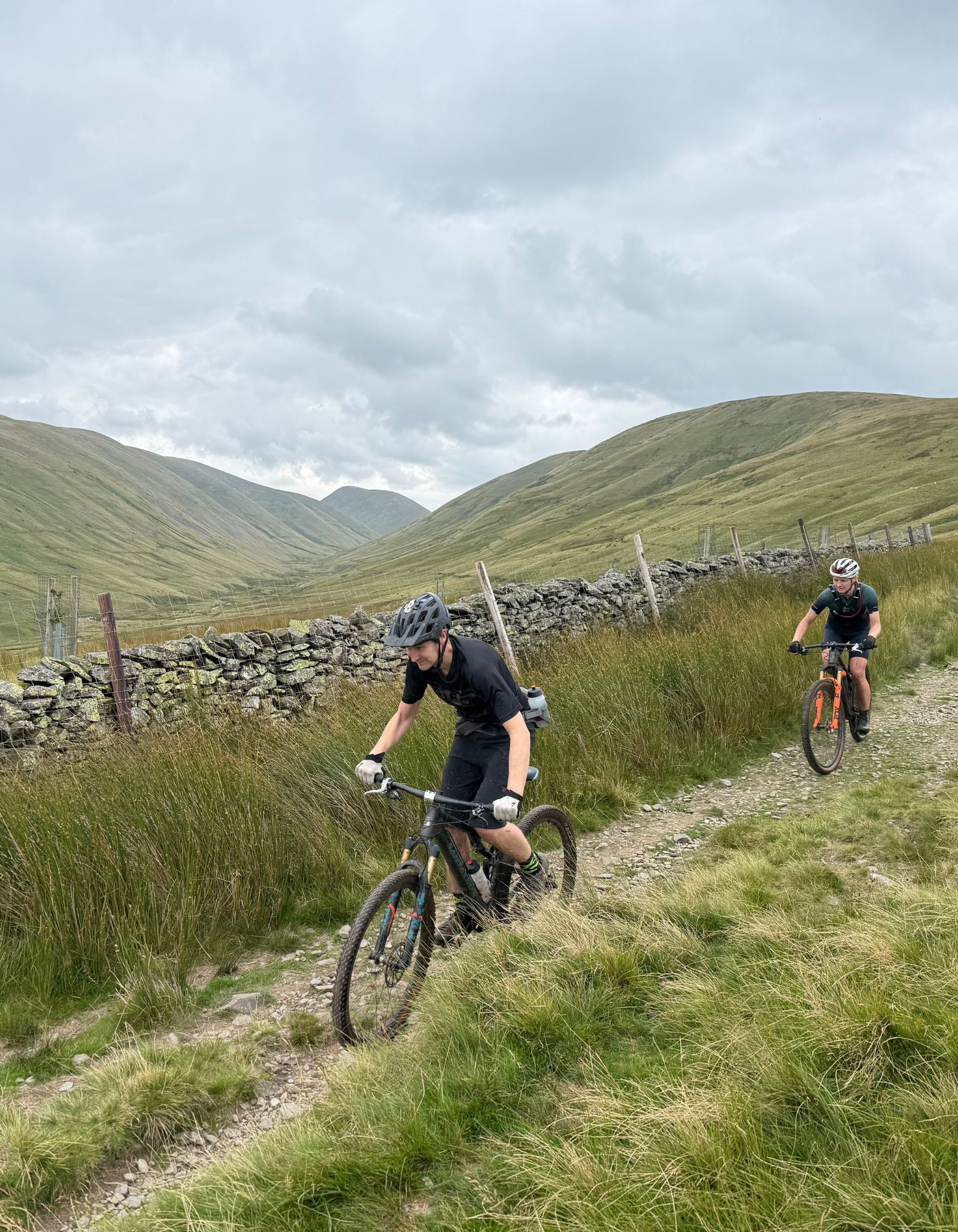
Calf to Bowderdale 8.2-17.2km
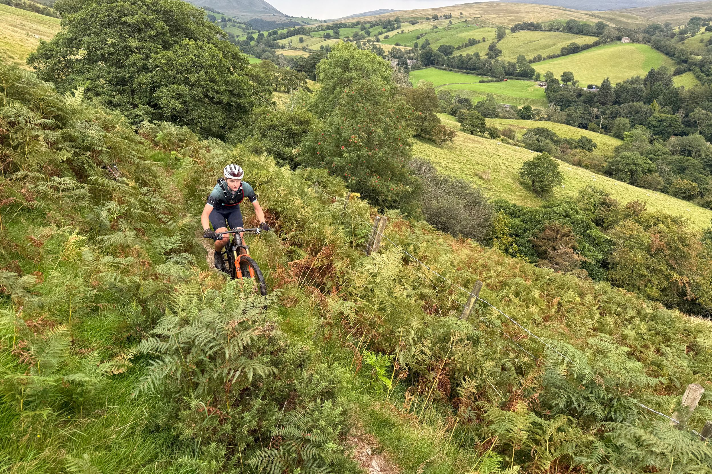
The descent that makes all the climbing worthwhile starts setting out it’s character straight away. A skein of interlaced single tracks switch between cleanest, smoothest lines for some swerve and swap fun before distilling into a single ribbon through the grass and heather. Regular rock sections and swerves across mini gulleys formed by streams to keep you on your toes and occasionally on your brakes as you drop deeper into the valley. Don’t be tempted to push too hard though as you’re a long way from help if something breaks or you crash, so ride well within your limits.
While the super narrow singletrack, with a steep slope down to the stream on your right, is pretty intensive in terms of concentration, try and grab some head up time to take in the stunning landscape you’re riding through. This kind of truly unspoilt remoteness is increasingly rare as more people are TikTok tempted into the ‘wild’ so savour the secret serenity of the Howgills while you can. As the gradient relaxes about ten minutes into the descent your arms will get a rest but your legs will have to take up the slack to keep the flow going as occasional flats and rises enter the equation. It’s likely to be a bit soggier lower down but even the lower roller coaster singletrack section is still trending mostly downwards. Things tip down again as the trail opens up and finding the clean lines through the patchy grass becomes a twisting chase again rather than just Scalextric slot racing. Then it’s through the gates and down the farm track for the last few hundred meters to the road and a chance to relax and refuel.
Bowderdale to Ravenstonedale 17.2-24km
Follow the rise and fall backroad through the tiny hamlet of Bowderdale down to the main road underpass. Don’t go under this unless you want to take the 62km extended option. For the 40km loop stay this side of the main road for 200m and then turn right following the bridlepath sign up the old wall lined drove road south with the Howgills ahead. It’s not time to go back into the big hills yet though as the ancient stone track curves round eastwards to join the back road through the scattered houses of Weasdale and across a section of open moorland. A right turn through a gate, across pasture and an old bridge leads into a narrow climbing section and drove roads where you’ll need to watch the rocks hidden under the grass. Then it’s more pasture and drove road with views up to the north across the upper Lune valley.
Back onto the road and into the village of Ravenstonedale marks a brief return to a less remote vibe, and you even get the choice of two pubs to rest and refuel at. Don’t be shy about getting the snacks and a sugary shandy down either, as unless you’re fine grazing on grass then it’s another 10km before a potential feed at the Cross Keys.
Ravenstonedale to Narthwaite 24km-32km
It’s a gentle start to settle those snacks as you tap up the dead end road towards Adamthwaite through rolling pastures and the signature stone field barns of the Yorkshire Dales. After 3km of gentle climbing things get bitey again as you drop down to the stream and then up a double arrow (the official Ordnance Survey designation of a savage slope) kicker. It’s only short though and the brief burn should ease off just in time to spot the grass track peeling off down to a stream on the left.
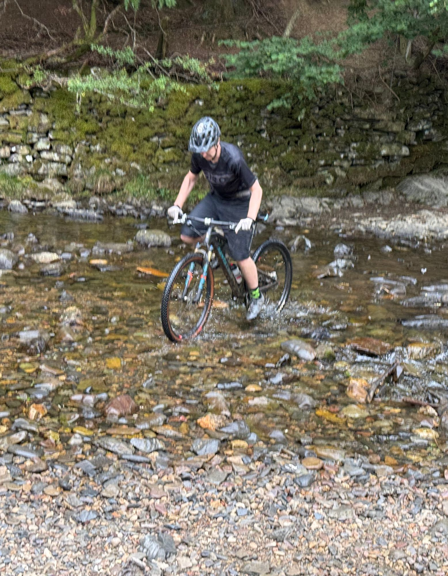
This stones up and levels out to give you great views across to Adamthwaite farm sheltering in the shadows of the towering Howgills. Be careful of the rocky patches on the double track descent though, as they come up fast and they’re toothy enough to flat an XC tyre as Amy found out to her cost. Don’t go straight on into the farm at Murthwaite either, turn right at the entrance wall and through the undergrowth and a couple of gates to access one of the real surprise treats of the ride. Starting as a snaking singletrack through heathy moorland, this delicious descent ramps up the radness as you drop into the woods. Here the rocky, rooty singletrack snakes in and out of a washed out gulley before dropping you down to a ford. Watch the final rocky section into the stream as it’s treacherously off camber and very slippery when wet. Both Niall and I ended taking a bath as a result!
Whether you get rinsed yourself or not the next section of the ride is really refreshing anyway, as you pedal through a really rural section of meadow and up a track under trees which feels totally different to the rugged vibe up to this point.
Narthwaite to Sedbergh 32-40km
It’s hard to tell if anyone still lives at Narthwaite farm, but the curious cows gave us a warm welcome from over the wall as we sneaked through the gate. Then it’s a hook round and down to another slippery stream crossing before yet another change of terrain. Broad double track is replaced by narrow singletrack contouring along the edge of the hill. There’s enough rocks and wiggles to keep you on your toes if you push the pace too, so it’s a proper fun way to start the end of the ride. If you need a break or just want to visit a wonderfully preserved 14th century coaching inn, look out for the path that drops down to the Cross Keys at 33.5km. By all accounts the food is excellent too but don’t expect anything but soft drinks as it’s a temperance inn that reflects the strong Quaker history of the area.
The singletrack continues through bracken moor or open farmland to Low Haygarth where you get a surprise section of cinder path that takes ramblers up to the waterfall of Cautley Spout. Cascading nearly 200m in total drop, it’s the highest open waterfall in England and well worth the km or so push up to visit if you’ve got time. To continue the official route though, leave the cinder path and cross the footbridge at Low Haygarth to start another 3km section of shelf singletrack above the beautiful River Rawthey.
Then it’s a fast drop down a concrete and rock road into a gated wood before the final up and over to join a narrow back road at 37.5km. This rolls gradually down to join the main road for the final kilometre into Sedbergh, providing the perfect opportunity to warm down under the watchful gaze of the Howgills. Not a landscape to treat lightly but an incredibly rewarding and rare one to ride through as we hope this ride will show.