September 2025
54°22'37.9"N 2°48'54.1"W
September’s Polaris Bikewear Trail of the Month takes us steep and high into the Lake District for an absolute classic figure of eight mountain bike adventure including Garburn Pass, Gatescarth Pass and Nan Bield pass. Expect incredible loose rock and snaking singletrack descents, as well as jaw dropping views in a truly wild and mountainous landscape. You’ll have to earn all that with brutal technical climbs and ‘hike-a-bike’ carries though. Plus, while the surfaces are ‘all weather’ some big elevation, exposure, challenging descents and very limited phone coverage means it’s not a route for the feint hearted, particularly foul conditions.
The good news is that you can easily break it down into separate Garburn (24km) and Nan Bield (20km) rides. Our route also includes a 5km ‘Green Quarter’ bonus loop which you can add/dodge at your discretion on the day. The start point at Staveley is super easy to get to from the M6 or by train too, making it an absolute winner in terms of classic Lake District riding without the normal crowded road inconvenience. BTW when we say MTB loop we mean it on this one, it would be horrific on tall gears, narrow drops bars, and skinny tyres.
POLARIS GARBURN AND NAN BIELD
43.4KM, 1,581M VERTICAL
Start and finish point - Staveley is 12 miles from J36 of the M6 on the A591 Windermere Road. If you’re travelling by rail take the west coast main line to Oxenholme, and then switch to a local Northern Rail service to get to Staveley.
what3words ///calm.encrusted.facelift
This what3words address refers to a 3 metre square location. Tap the link or enter the 3 words into the free what3words app to find it.
For full navigation data download the GPX file and watch the Strava fly through. Then watch our ride video for a highlights preview of the route.
Stops & shops
There are toilets, several excellent cafes and various shops, Wheelbase bike shop and even Hawkshead Brewery in Staveley where you start and finish.
The Staveley Mill car park is contactless pay and display but make sure you book more time than you think you’ll need as there’s limited phone signal to add more time once you’re riding. We didn’t when filming the guide video and had to cut out the Green Quarter end loop as a result.
Make sure you take more snacks and drink than you think you’ll need too, as apart from a petrol station after 3km there’s nowhere else to grab more snacks and drink until you’re back at Staveley.
Watch out for
We’ve already said it, but this is a proper mountain route with significant risk of falls, mechanical issues and extreme weather so take extra clothing, food and water even in summer. Gatesgarth and Nan Bield passes are extremely exposed and will magnify any bad weather so keep a careful eye on the forecast and take storm survival equipment if there’s a remote chance you’ll need it.
In terms of the route make sure you take the cycle path to keep you off the main road for the first 3km. Don’t assume the narrow, twisty Borrans back road is quiet either as it can be a busy rat run to dodge Windermere and Ambleside traffic.
I was going to pick out the individual perils of each descent separately but TBH all of them need treating with serious respect. Expect big loose rocks which are often wet and slippery with occasional drops (Garburn Pass) steep switchbacks (SadGill, Gatescarth and Nan Bield).
Nan Bield also has a steep, slippery grass/moorland section at the end that’s got plenty of tyre killing rocks hidden in it too. In other words all the descents are gagging to kill tyres and/or send careless riders flying and it likely won’t be a comfortable landing at any speed.
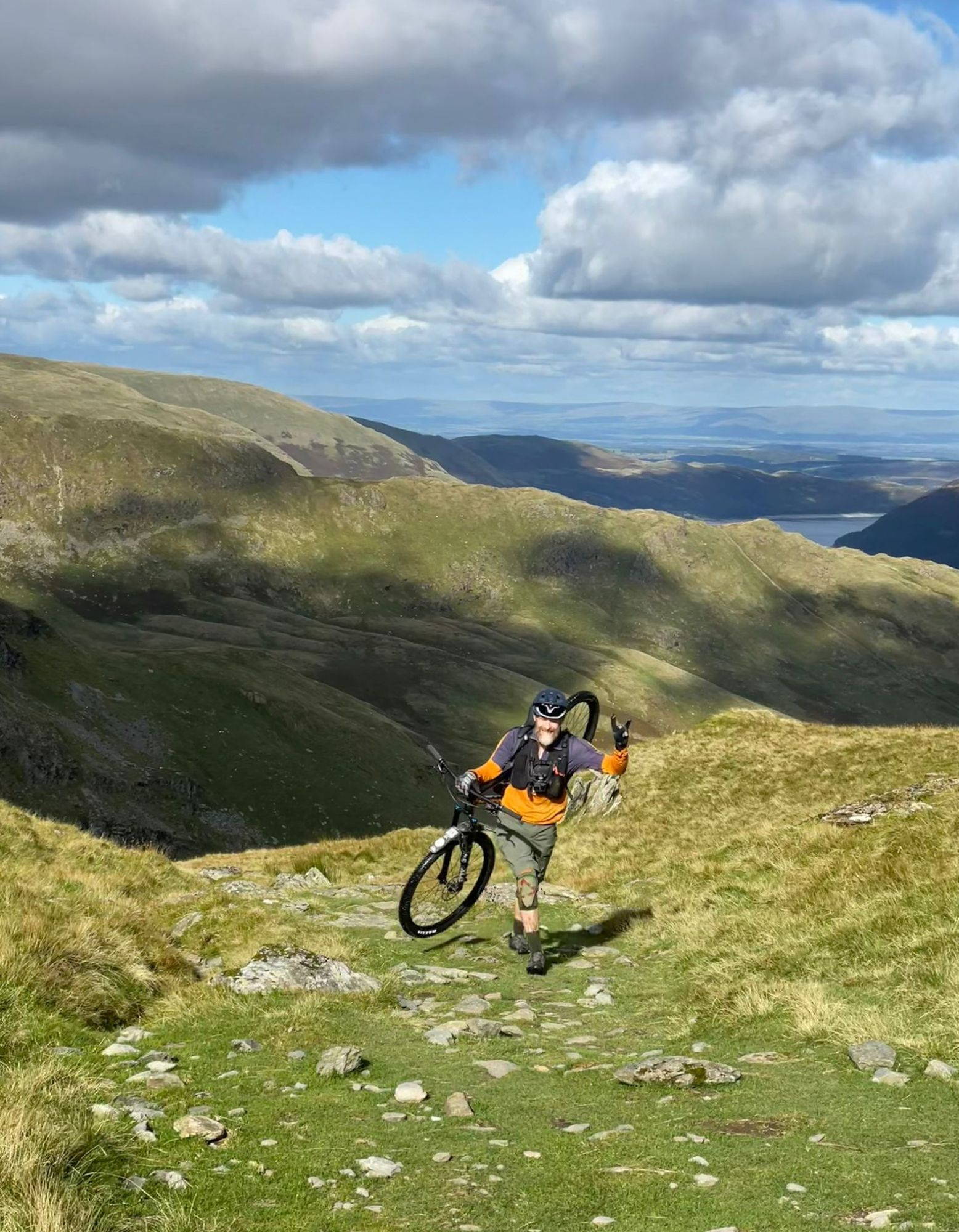
So do yourself and the Mountain Rescue Teams a favour, ride well within your skill level and carefully walk sections you’re not sure about. For safety reasons we’d definitely advise against riding alone or with less experienced riders too, and the 40 minute plus hike a bike up Nan Bield will be a painful process with an E-bike.
On the plus side, navigation is super easy for the whole loop so you shouldn’t have to stop much to check maps / GPS.
Route information
Staveley to Garburn Pass 0-10.5km
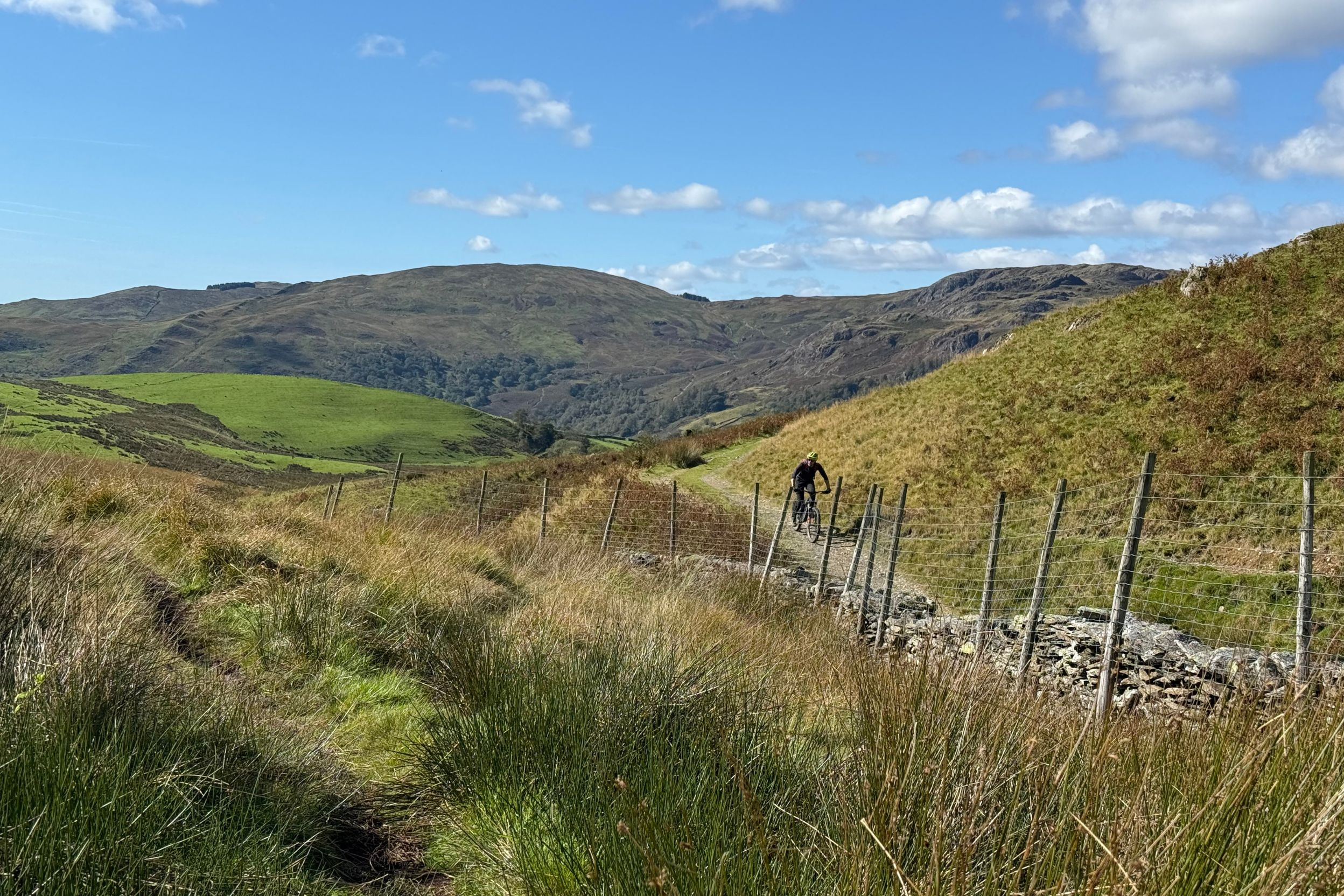
Parking at Staveley Mill car park is the best option as it puts you right on the doorstep of Wilf’s Cafe and More Bakery for pre supplies, Wheelbase bike shop for any riding needs, and Hawkshead brewery for a pint at the finish. There are a surprising amount of other shops and eateries for such a small village, so have a look around if you fancy something else. Follow the main street west towards the A591, but turn right before the main road to get onto the shared use pedestrian/cycle path. After 3.2km turn right (north west) on the rolling, climbing road signposted Borrans. Don’t take the bridleway marked High Borrans though, stay on the road enjoying the views of the western Lake District fells until 6km where a track peels right from a left hand corner.
You’ll now climb gradually up a gravel track for 2.5km past Dubbs Reservoir with views across Troutbeck towards Ambleside and back over your shoulder to Lake Windermere. The climb gets steeper and the rocks bigger and looser at around 9km, and even if you’re fit it’s a proper traction, torque and line choice challenge for the next km. Remember that this is just the first (and shortest) steep, technical climb of several so be sensible rather than stubborn if it feels like you’re about to blow a gasket. Thankfully there’s a bit of breathing space as it flattens up and solidifies near the top, giving you the first glimpse of the route ahead in the process. Remember to flick off any compression damping you might have added to your suspension for the climb.
Garburn Pass to Kentmere 10.5-13.5km
That’s because once you roll through the gate at the top of Garburn Pass you’ve got about 10m of relatively calm rocky track before you tip off a partially exposed black plastic drainage pipe into the first potential over the bars drop of the day. From here on line choice is mostly a lottery where weaving one way to avoid a potential wheel eater will potentially put you straight into the jaws of another. Having ‘followed’ locals down here and watch them pedal into the distance scattering serious geology like clattering cattle there’s definitely some merit in relaxing and letting speed smooth things out. If you’re not used to a bike slithering and writhing about underneath you while sounding like you’re stuck in Slipknot’s drum kit, picking your way down carefully and cautiously is definitely the best approach. Even then there are some repeated drops to roll down and if it’s wet it’ll be slippery too so if in doubt swap walking pace for actual walking.
Don’t think the stream after the switchback section is the end of the drama either. Yes it flattens out for a bit but then it’s back onto the random rock and drop rodeo that gets thinner, wetter, darker and potentially lethally leafy in autumn as you drop in alongside the dry stone wall at the bottom. Share stories of narrow escapes and sketchy moments as you open the gate at the bottom, and then drop down the short section of road wriggling into Kentmere with its medieval church and fortified tower house.
Kentmere to Sadgill 13.5-18km
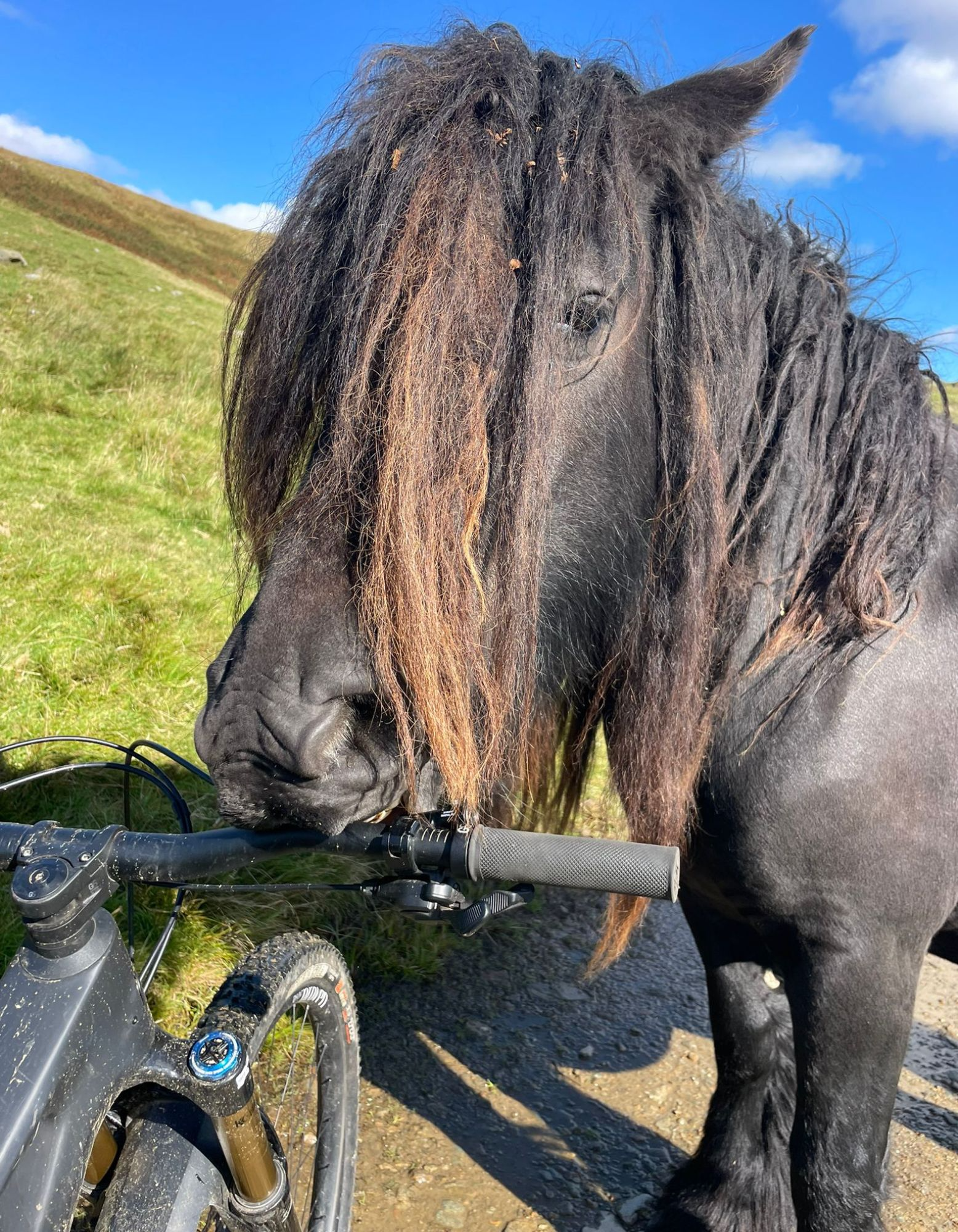
Cross Kentmere bridge and turn left immediately up the very narrow, high walled lane. Climb round towards the right and then double back left at the T junction, gaining height quickly (yes that’s the diplomatic way of saying it’s steep… but at least it’s Tarmac not loose rock this time). As the road levels out, look out for the wide open mouth of the drove road on your right at 15km, and head up the gradually climbing grass over rock double track. Compared to all the other up and overs on the ride, Stile End is a welcome chance to tap out tempo as you rise though a quietly isolated and often forgotten part of the lakes where you’re more likely to meet free range hill ponies than people. Be aware that those ponies are keen to try and nibble anything that might taste a bit different to grass though so handlebar grips or clothes might end up as horse d’oeuvres.
The descent to Sadgill starts off relatively calm as it sweeps round the high point of Tom’s Howe, but then suddenly drops into a very steep, big cobble surfaced S bend over a blind brow. The solidly embedded rocks means it’s less sketchy than the loose rock of every other descent, but it can still be a slippery surprise in the wet. Through the gate and it’s fast and slightly loose with some little water ditches to pop across, and enough swerve to keep things exciting. Especially the last right turn as you get to the house as there’s a shut gate immediately round the corner. Cross the old bridge over the River Sprint (yes really) and get some food and water down ready for the next section as that definitely won’t be a sprint.
Sadgill to Mardale Head via Gatescarth Pass 18-24km
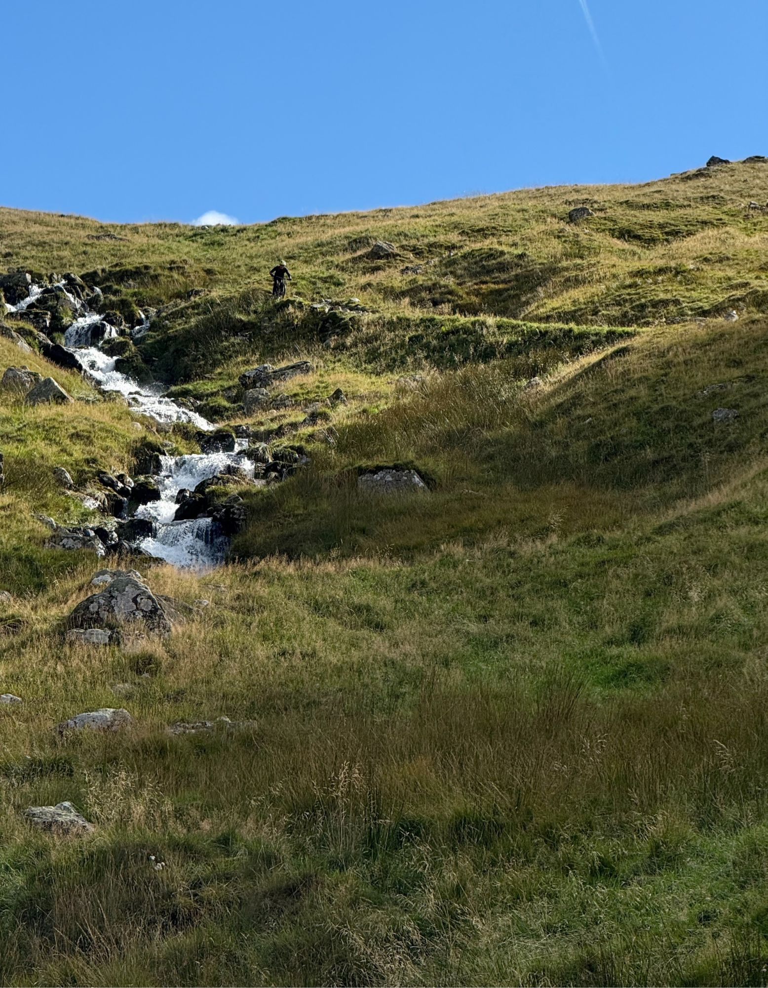
The rocky, broadly wall lined track winding its way gently up between Goat Scar on the left and Buckbarrow crag on the right is picture perfect for the start of some sort of ‘fantasy enchanted journey’. You won’t be clattering along the loose surface for long before the suddenly steepening slopes that create it’s 400m of elevation roll into view though. Even at its steepest points it’s not so much the gradient, as the surface that’s really against you as you desperately swerve from one side to the other trying to find the least rocky, most solid line. If you’re skilled / lucky enough to reach the final kick of the first pitch without already walking, a fleeting section of rough concrete is replaced by joltingly feral cobbles that will blow your back up even more than your legs. Alternatively, if you decide to end the suffering showboat, you’ll have plenty of time to enjoy the views back down the valley towards Stavely and the rushing waterfalls which are the starting blocks of the River Sprint.
Unless you’re some sort of aerobically overachieving supergroup, the first gate is a good point to regroup for a short, relatively flat section of pasture track before the climb somehow gets steeper, looser and twistier than before. Again, sensible riders will push, while idiots will rack up the lactic regret for later in the ride. If you can’t guess already, you can see which option we took in the ride guide video. It’s also worth noting that while we had mercifully calm conditions for filming, the wind often funnels down the valley with ferocious force, making progress even more painful.
Once you’re at the top though, the reward is both immediate and awesome, with a seemingly endless series of loose rock switchbacks dropping 350m down to Mardale Head. The views up Haweswater are fantastic too, although don’t get too carried away with the scenery spotting as there are some awkwardly flat, blind turns and fairly chunky bits of unforgiving geology between you and a safe arrival at the bottom.
Mardale head to Green Quarter via Nan Bield Pass 24-32.5km
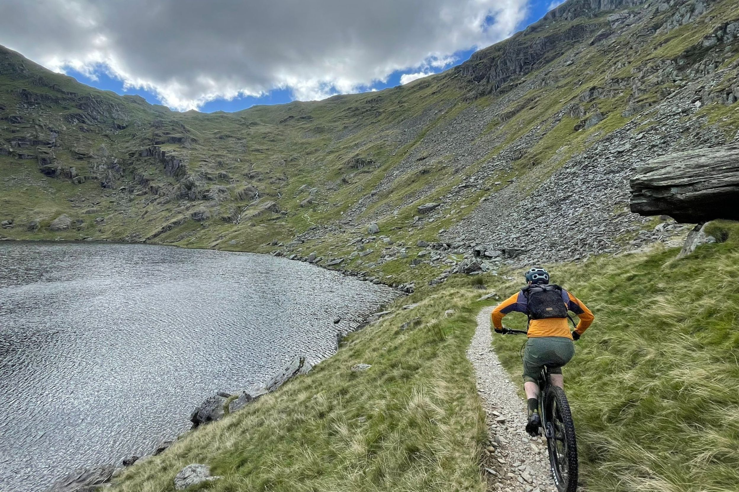
Even with just a couple of short stops to try different carrying methods or take in the genuinely spectacular views over our shoulders, the next 2.5km of the route took us the best of an hour. That’s because apart from some very short sections of technical pedalling at the bottom and then again around the shore of Small Water tarn, your bike will be on your shoulders. Not in a casual stroll up a simple slope way either. Nope, this is a proper scramble / carry that’d be a workout even just walking, and in many sections above the tarn there will be a borderline waterfall too. We did say at the start that this was a proper MTB adventure though so don’t start snivelling now. Keep your head up and keep getting snacks down as the last thing you want when tackling the Nan Bield descent is a sugar wobble. It’s definitely worth fuelling on the hoof too, as while there is a shelter cairn/wall at the top (Nan Bield actually means Anne’s Shelter) even on a calm day it’s a cold and windy spot so not somewhere you want to hang about too long, however good the views in either direction are.
Nan Bield is a significantly different descent to the previous plummets too. Obviously, there are still loose rocks and lips eager to pinch flat your tyres or put you over the bars. But for the top section they’re in the bottom of a deep, narrow, switchbacking rut. Perfect for riders who’ve spent time on Alpine paths practising clever little wheelie turns and hops, but a heavy braking handful for those who haven’t. The path then straightens out into a series of trials style boulder and jagged edge challenges, before you reach the relative calm of the long singletrack descent above the glistening waters of Kentmere Reservoir. I say relative as there are still plenty of rock and hop situations all along the trail, often complicated by the fact that it often doubles as a stream. Having survived all the sniper rocks on the singletrack, we thought we were safe as we swerved and humped down what seemed like more forgiving peat and grass moorland towards Hallow Bank. That’s exactly when I managed to hole my rear tyre on the final water bar in an awkward stream sequence though, so don’t let your guard down at any point in the descent.
That includes the fast and fun roll out along the farm track through several fords where there’s still plenty of rocks waiting to wound your wheels. While it’s not that clear on the ground, stay high on the grass on the bridleway above the obvious farm track (which is actually footpath) before dropping down and across at the first handful of houses onto Low Lane track, which turns into another section of rocky singletrack between tall dry stone walls.
Kentmere to Staveley 32.5-43km
Popping up onto the road from the singletrack at Green Quarter you’ve got two options. If you’re running short on time, energy, or paid for parking (like we were) you can head straight down the road to Staveley. If you’re game for a final 5km of top quality off road though, take the bridleway left uphill (32.9km) almost immediately after joining the road. This puts you onto a gradually climbing track that skirts through the rocky outcrops below Rasp Howe crag and then hooks round left, pitching up more steeply to the saddle of Green Quarter Fell. From here it’s a mix of multi line track and probably soggy singletrack down to the edge of Skeggles Water. Double back at the bottom corner of the lake and climb slightly on multi options single trails before joining the more established, roller coaster descent cart track. Follow this down to the gate at the field wall at 38.1km, where our official route heads back west on rutted singletrack down to the final rowdy, rocky descent through HP Plantation. If that sounds a bit muc, go through the gate southwards along the farm track before joining the singletrack road of Hall Lane back to Staveley.
However you end up getting there we reckon you’ll feel like you’ve had a proper adventure by the time you’re rolling back into the village after one of the most intense 40km routes we know.